A few months back, I decided at the very last minute to drive down to Mt Saint Helens for a hike and to see if I could figure out conditions on the Mt Whittier Trail. Mt Whittier had been on my to-do list all year and I figured I should go see for myself if it was worth doing. I also wanted to see if it lived up to it's reputation of being a difficult trail and if it was something I wouldn't mind hiking solo. It turned out that I wouldn't need to go solo as I ended up hiking it a month later with a couple new friends. That's a different story altogether but I can confirm that hiking Whittier alone is doable but probably not the smartest thing you could do.
I left my house very late in the morning. It was around 9:00 am if I remember correctly. The drive to St Helens is a long one from my house and I didn't make it to the trailhead until after 12:30 in the afternoon. Since it was so late in the day, I gave myself a turnaround time of 4:00 pm. Three and a half hours would be plenty to get out to the Whittier trail. This would allow plenty of time to get back to the car before dark.
This being my first hike in the Mt Margaret Backcountry, I really didn't know what to expect. I would be even more surprised since I ended up bringing the wrong map of the area. I knew Mt Whittier trail was up beyond Norway Pass but I would have to figure it out as I went. Not a good thing to be unprepared like this but I at least had the GPS on my cell phone. Heading out on the Boundary Trail, I kept a track of my steps using the GPS in case of the unlikely event I became lost.
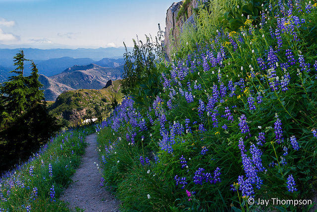
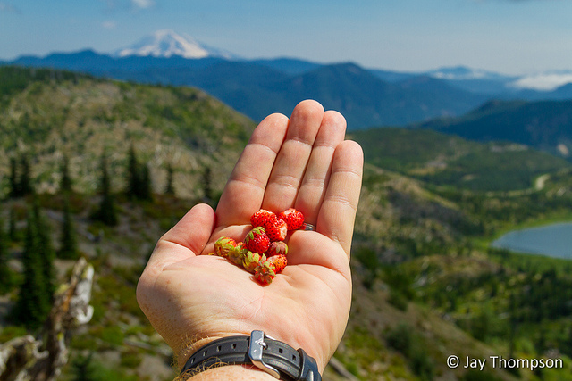
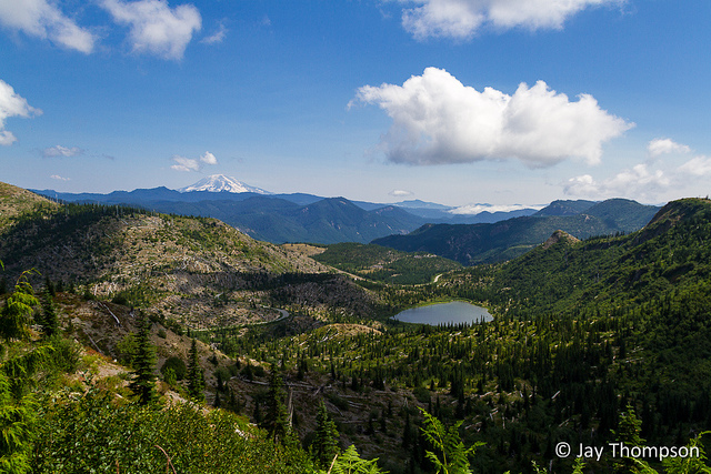
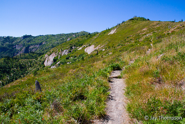
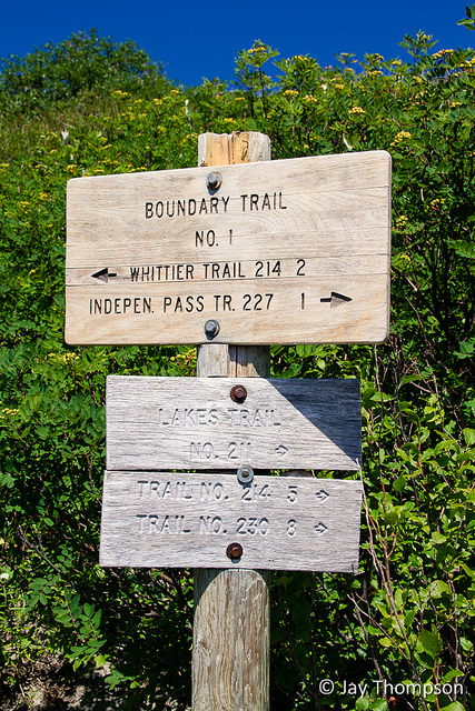
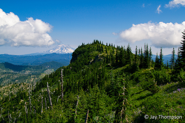
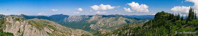
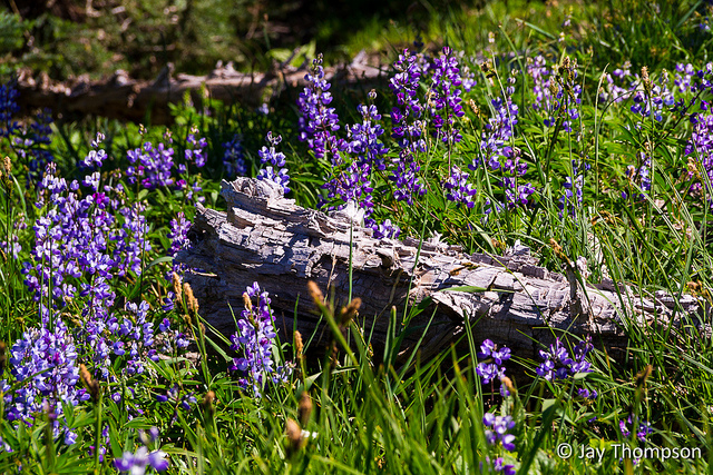
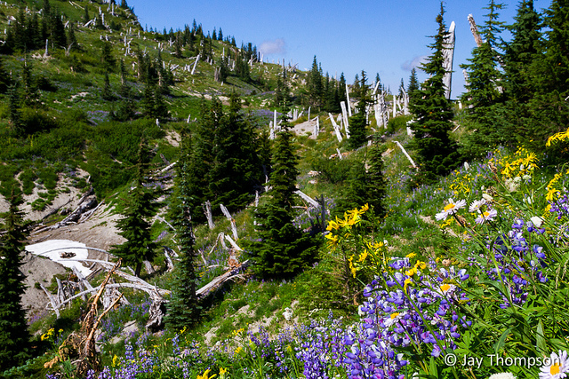
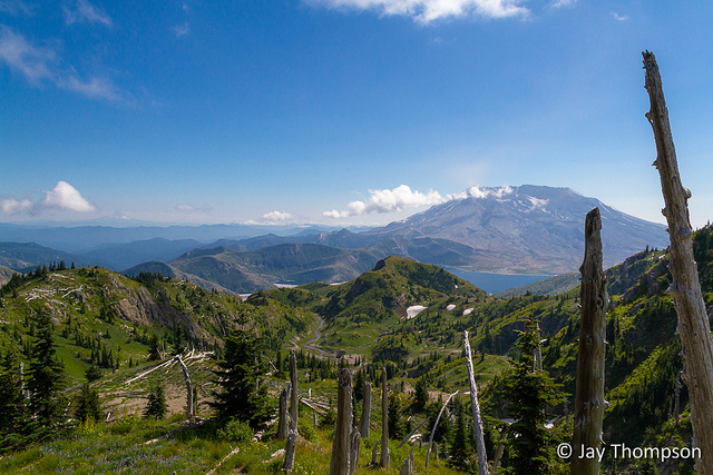
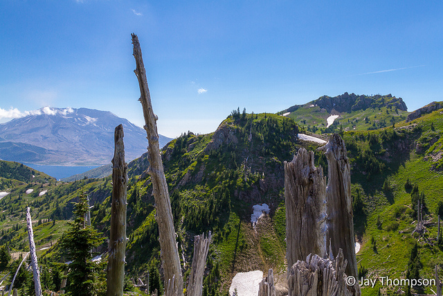
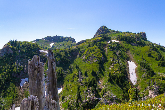
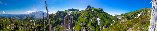
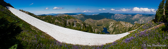
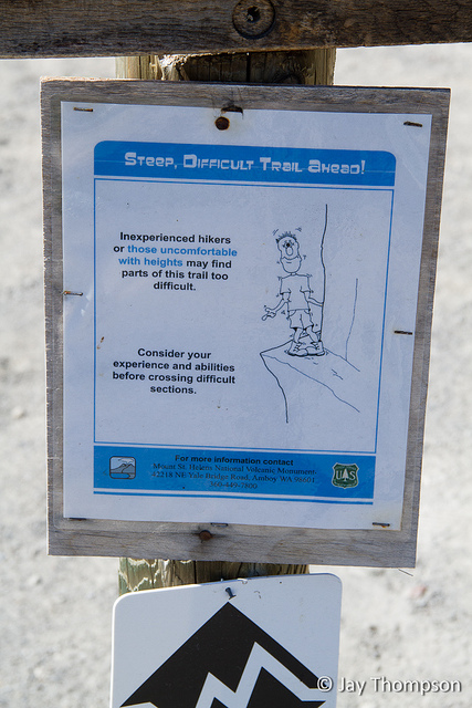
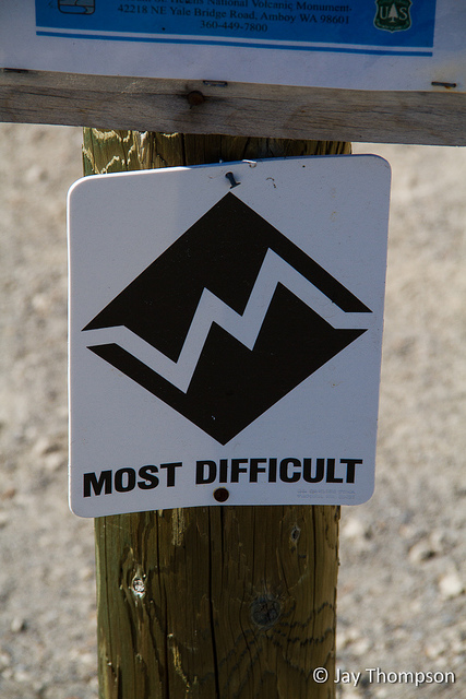
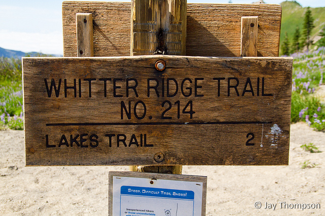
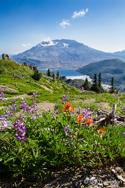
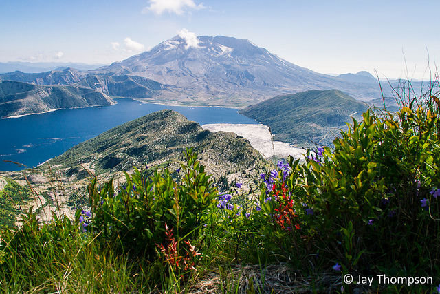
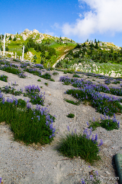
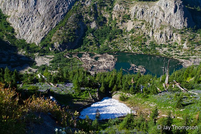
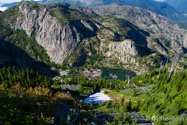
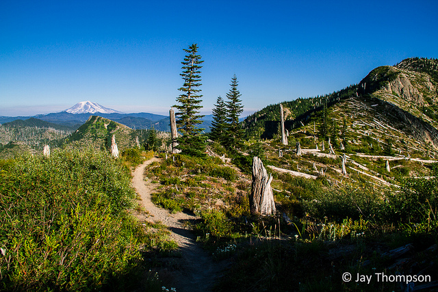
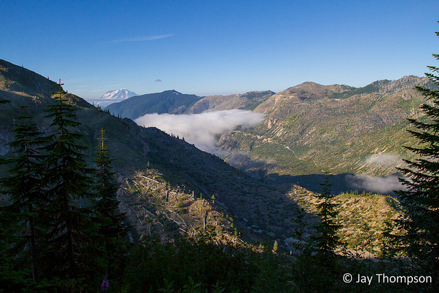
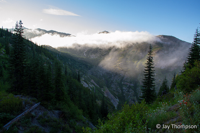
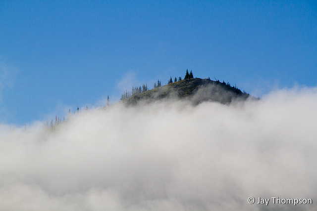
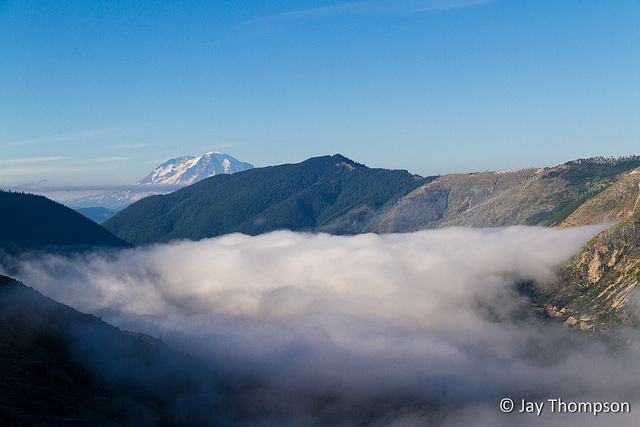
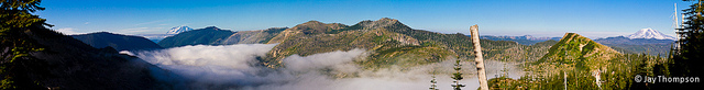
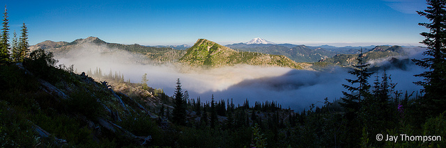
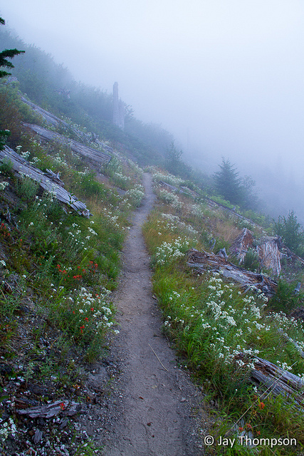
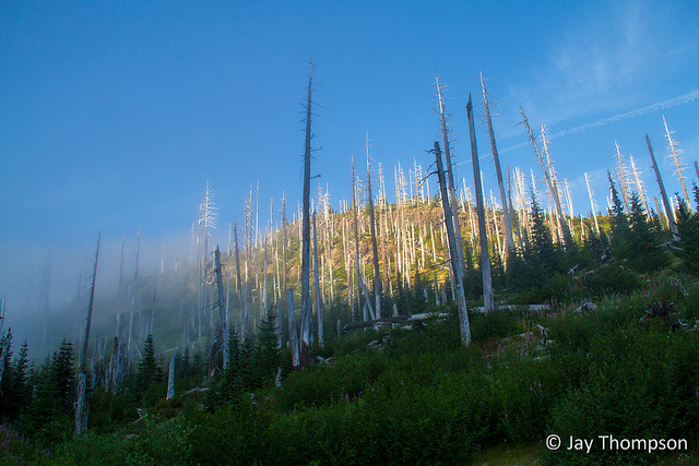
Norway Pass Trailhead on the Boundary TrailAlong the way up to Norway Pass, I couldn't help but stop every so often to pick wild strawberries. They were delicious.Looking across to Mt Adams in the distance. Meta Lake and Forest road 26 in the foreground.Upon Reaching Norway Pass, an excellent view of Mt Saint Helens and Spirit Lake reveals itself.The trail as it climbs above Norway PassSign for the Lakes Trail just below Bear Pass. You would take a right here to do the Mt Whittier Loop counterclockwise. I stayed left which stays on the Boundary Trail. Going this way takes you to the Mt Whittier Trail to do the loop clockwise.First view on Mt Rainier for the day.Mt Adams from ridge above Bear PassPanorama of Rainier and Adams shot from same spot as previous two picturesTent caterpillers.The wildflowers were amazing. These lupine were very fragrant.Lupine carpeted much of the ground through this sectionThe views were simply fantastic!Flowers, flowers everywhere!This area took the brunt of the blast, but as you can see it is recovering nicely. The whole area is very green and lush with vegetation.Mt Margaret in viewThe trail crosses the top of the snowfield as it climbs to the saddle seen above the snag. Mt Margaret can be seen in the distance beyond the saddle.Mt margaret Backcountry Panorama - Mt Margaret left of center just above snagSnags everywhere are a constant reminder of the great forests that were here before the eruption.Near the Mt Whittier trail junction looking across to Mt Rainier and Boot Lake below.Mt Whittier Trail junction adviceNever seen a black diamond trail before.At this point the trail signs were confusing and if I had not brought the wrong map I would have known which way to go. As I now look at the sign, I can clearly see what looks like an old faded arrow just to the right of the number 2 showing which way to the Whittier trail. I didn't see the arrow at the time. It was at this point that I ended up going the wrong way, but in retrospect, it was OK because the views going the other way by Mt Margaret were simply amazing.......views like these flowers...and these flowers and view of the mountain....and Spirit Lake and an in your face view of the mountain.Beauty everywhere you turned. This is looking back at Mt Margaret from about where I turned around. There was a side trail going up Mt Margaret itself but I saved that adventure for next time.Back at the confusing Mt Whittier trail junctionHeading back down towards Norway PassI stopped to get a shot of the logs floating on Grizzly LakeGrizzly LakeLooking down at Grizzly LakeCloser down by Norway Pass, my journey was impeded by all the hucklberry pickingMt Adams from Norway PassSome people describe all the berries they see along the trail and declare they had never seen so many. It was true! I had never seen so many huckleberries. I ate my fill before picking these to take home.On my drive to Mt Saint Helens in the morning, it had been cloudy all the way from my house until I got into the higher elevations. It cleared out about 15 miles before I got to the trailhead. On my hike back to the car as the sun was going down, the clouds started to roll in.It was intersting to see how quickly the clouds formed. They were not just being blown in, but were forming right in front of my eyes.Clouds moving inRainier and cloudsPanorama of Rainier to Adams above the Norway Pass trailhead. In a matter of about 10 minutes, this valley went from being clear to completely cloud covered.Very cool to see the clouds form beneath youWith the sun at my back, the mountain I was hiking down cast a shadow on the cloud below me. All was still and quiet and it was very surreal hiking down into the mist.Mt Adams and clouds Panorama. The Norway Pass trailhead and my car were waiting below.Into the mist
In closing, I have to say this was perhaps my favorite hike all year. The views were wide open from the trailhead to the top of the mountain and the huckberries and wild mountain strawberries were like the icing on the cake. The flowers were the cherry on top. Beautiful day on a nice, well graded, not too steep trail. In fact, I was so enthralled with the beauty all around me that I barely noticed the elevation gain.
Back in my car and on the road home.Sentinels of the past
 A few months back, I decided at the very last minute to drive down to Mt Saint Helens for a hike and to see if I could figure out conditions on the Mt Whittier Trail. Mt Whittier had been on my to-do list all year and I figured I should go see for myself if it was worth doing. I also wanted to see if it lived up to it's reputation of being a difficult trail and if it was something I wouldn't mind hiking solo. It turned out that I wouldn't need to go solo as I ended up hiking it a month later with a couple new friends. That's a different story altogether but I can confirm that hiking Whittier alone is doable but probably not the smartest thing you could do.
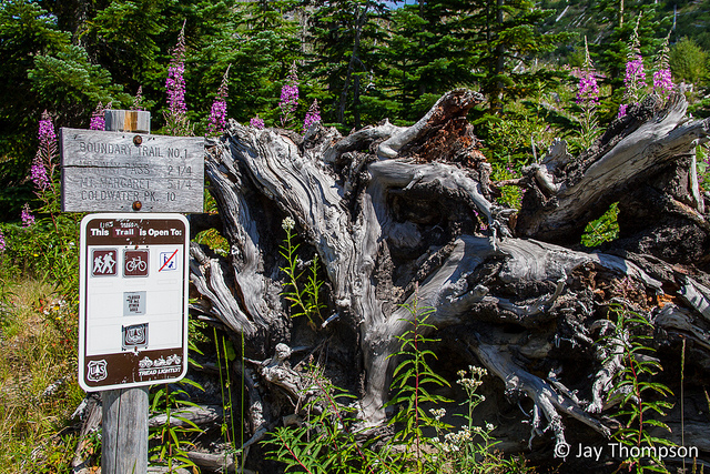


Such beauty. You are my eyes. You catch is all so well. Such great devistation leads to glorious beauty.
Thanks for sharing.
Thanks uncle Tim. Glad you enjoy reading about my adventures.
Great pics and post! Thanks. Ive been in this area and reading this makes me wanna hit up the trail again!
Go for it! It’s a beautiful place to visit.
I can see why this was your favorite hike of the summer….simply breathtaking!
Thanks Sue. I really enjoyed it and I’m looking forward to spending more time here next year.