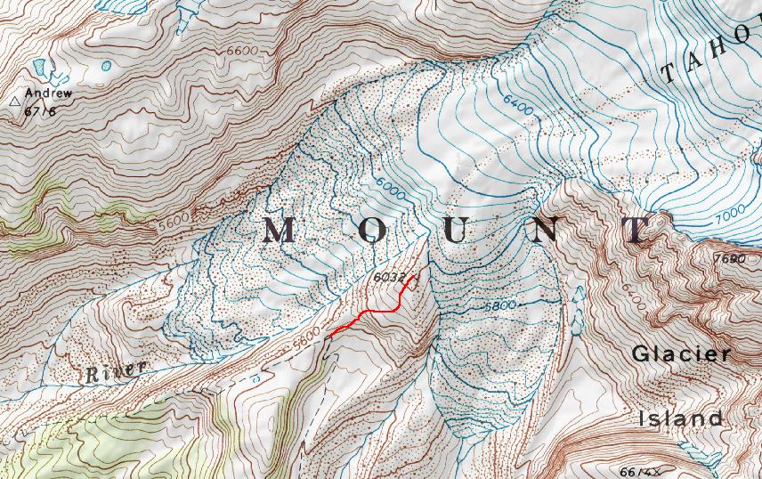
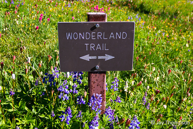
A long time dream of mine has been to hike the entire Wonderland Trail around Mt Rainier. Being a working guy with a family, it would be hard if next to impossible for me to take a large enough chunk of time to do the whole trail in one go. I don't have the luxury of taking weeks off at a time to go backpacking. Since the trail is billed by the park service as being 93 miles long, I decided the only way I would ever get it done, would be to do it in sections. My idea is to do it in 3 sections taking 3 day weekends to get it all in. So this year I went ahead and applied for the permit to do my first section, Longmire to Mowich Lake.
I was lucky. I got the permit for five people and the section and time of the year that I wanted. Now all I had to do was ask around to see if some of my friends wanted to join me. My friends Ron, Tess and Cheryl and her daughter Steph showed interest so I put them on the list. About a week before the hike, Tess informs me that Ron threw his back out and they would not be able to join us. Cheryl had also previously informed me that Steph was not going to be able to make it either, so at the last minute I had had to scramble to find some folks that wanted to go. Luckily my friend Paul who is a co-worker of Ron's said he would like to join. He was very enthusiastic about it in fact. So on Friday, August 24th after taking the day off specifically to enable a 3 day weekend for myself to hike the 35 some odd miles of this section, Cheryl, Paul and myself started off on the trail at Longmire.
The images below are shown in the order we saw them on this trip. The captions reveal the details much better than I can do in story form. There are a lot of images to load so it may take some time.
Day 1
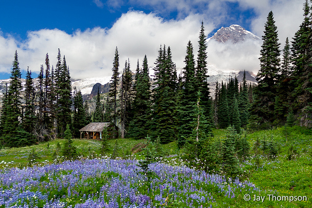
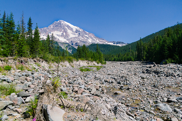
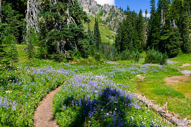
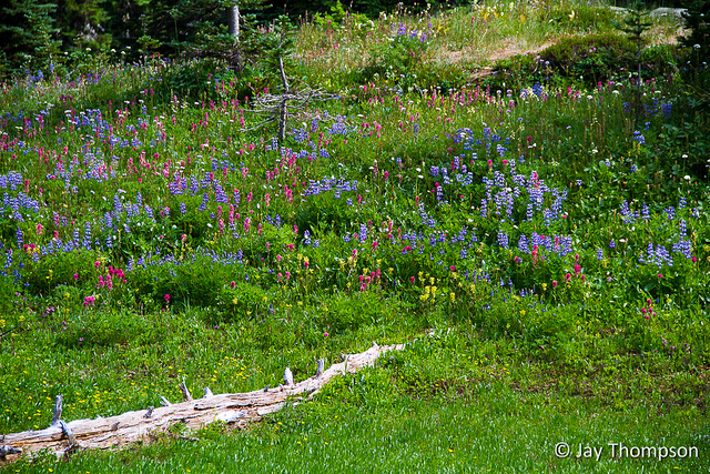
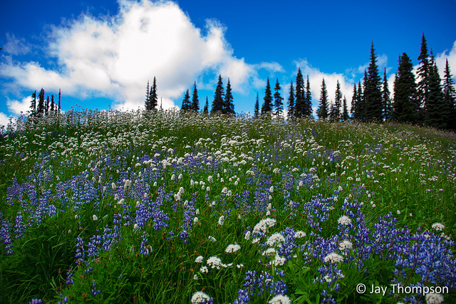
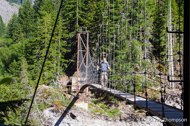
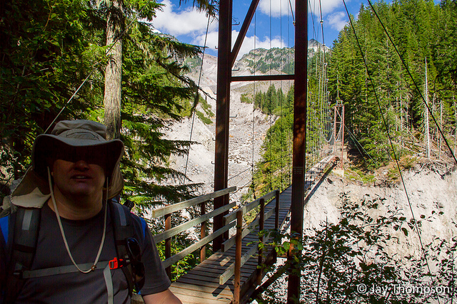
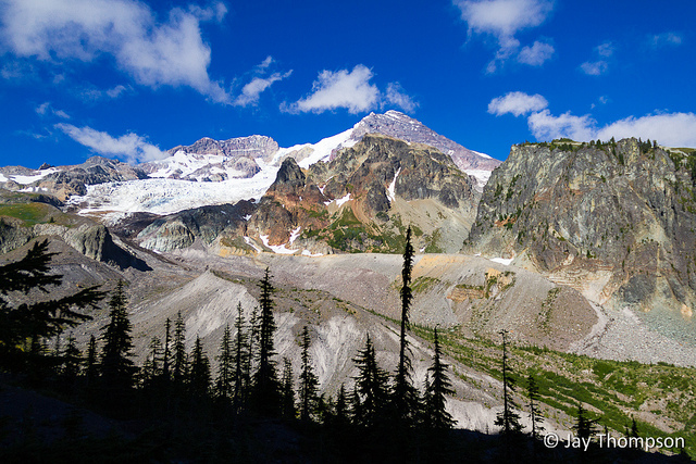
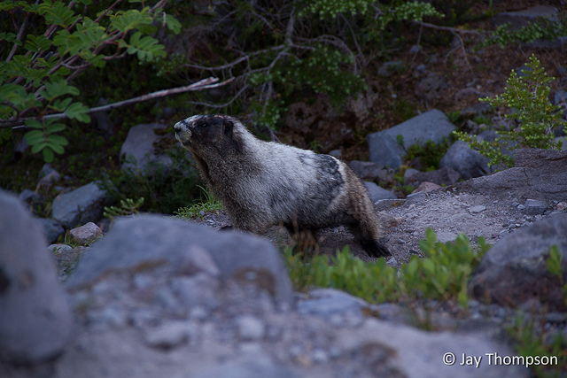
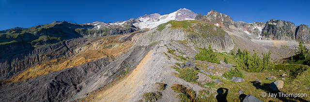
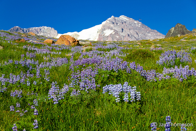
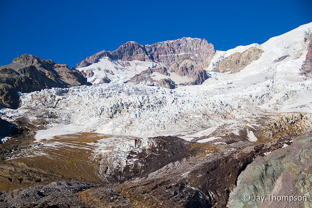
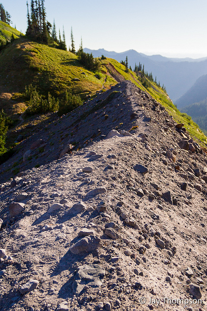
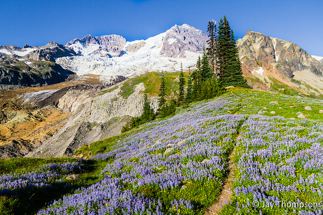
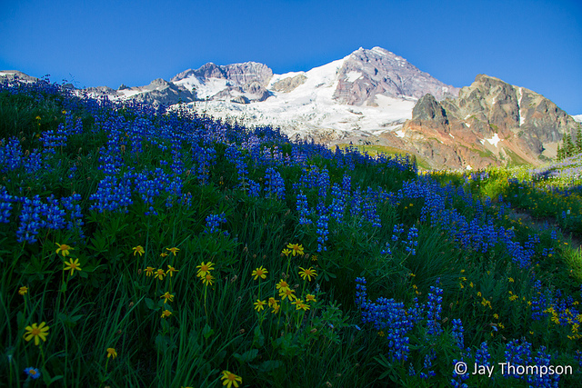
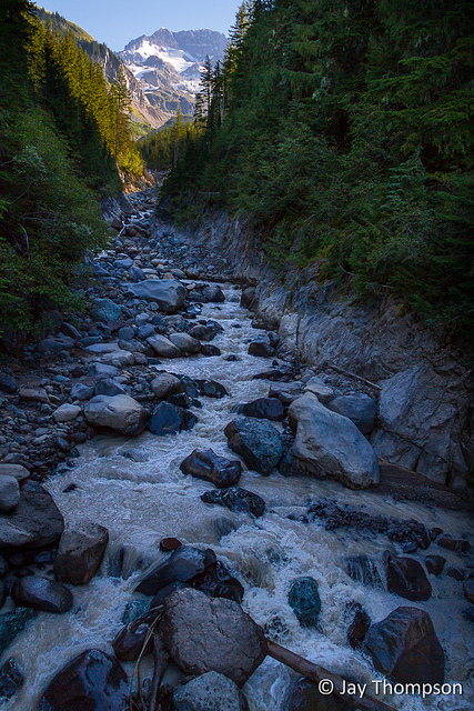
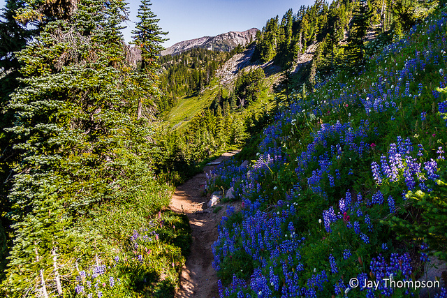
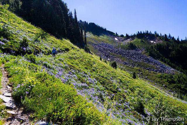
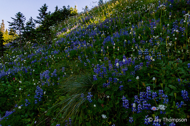
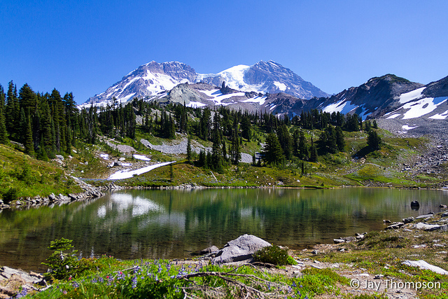
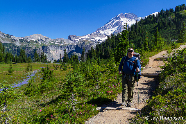
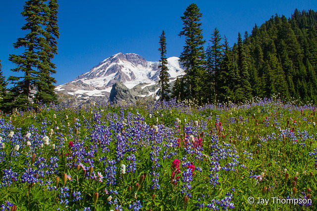
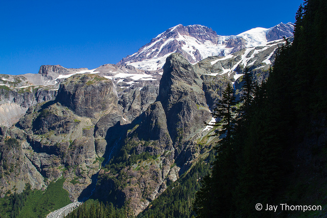
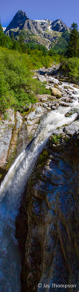
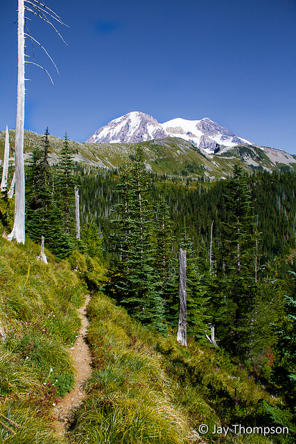
What is not shown in this picture or explained above is that we drove to Mowich Lake the night before and camped out there before driving to Longmire to start the hike. This shot is of Pyramid Creek. We took our first break here.The first Meadow going in to Indian Henry's Hunting Ground (Devil's Dream) and also the only tiny snow patch we crossed on the entire trip.The first Meadow going into Indian Henry's Hunting Ground (Devil's Dream)Squaw LakeMeadows full of wildflowers just before Indian Henrys Hunting GroundMeadows full of wildflowers just before Indian Henrys Hunting Ground. The fuzzies are sometimes called hippy on a stick, old man o' the mountain, old man's beard and old man's whiskers, among others. The official name is the Western Pasque Flower or Anemone occidentalis. These are the seedheads and not the actual flowers themselves. For an excellent video of the life cycle of the Pasqueflower, see this youtube link. Highly recommended!The flowers at Indian Henry's were gorgeous and the mosquitoes plenty.Indian Henrys Hunting Ground and ranger cabin. Very beautiful but the bugs drove us away. We still had miles and miles to go this day. The ranger came out and inspected our permit here.The suspension bridge over Tahoma Creek.It bounces and sways a little when crossed but seems to be pretty strong.Paul at the Tahoma Creek crossingTahoma Creek Suspension BridgeRainier peeking above Glacier Island. Glacier Island is just a big rock that the Tahoma and South Tahoma Glaciers flow around.Mt Rainier from the lateral moraine just below Emerald Ridge. Glacier Island to right of center.Almost to Emerald RidgeCurious Marmot near Emerald RidgeCurious Marmot near Emerald RidgeCheryl and Paul almost to Emerald RidgeFinally at the top of Emerald Ridge. I didn't know it yet but my next destination would be an off trail hike to the top of the round green hill displayed near the top and right of center of this picture.Looking down at Emerald ridge from a side trail to the top of a little bump above the ridge.At this point, Paul and Cheryl decided to head on down to camp. Previous to our trip, my friend Kathy told me to get a great view of the mountain and to get up close and personal with the Tahoma Glacier, that a hike to the top of the round green hill I mentioned earlier was in order - if I had the energy left to do it. Well, I was pretty darn tired after like 13 miles and 4000+ feet of elevation gain with an overnight pack but I just needed to see the top.I started up the green hill and after initially going the wrong way, I found some cairns going the correct way. The lupine was pretty amazing and very fragrant.Success! Upon reaching the top, I had an amazing view down on to the Tahoma Glacier.And this was one of the only times on the trip that I could see Mt Adams.Mt Saint Helens was also in the distance. The view was simply amazing from up here.Map of the off trail side trip at Emerald Ridge.Emerald RidgeFinally heading down to camp, I kept turning around to see what the view would be like going the other direction. Emerald Ridge would be forever burned into my memory, and I've since learned that this can be done as a day hike.Emerald RidgeThe lupine was very prolific......and fragrant.Last views back at Emerald Ridge and Tahoma Glacier.
Day 2
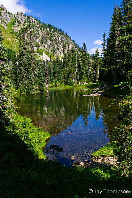
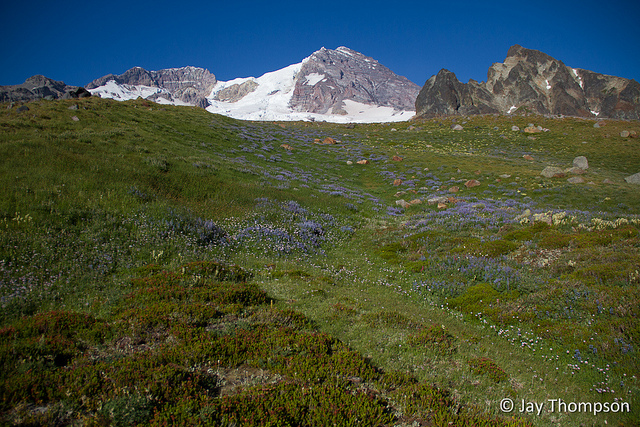
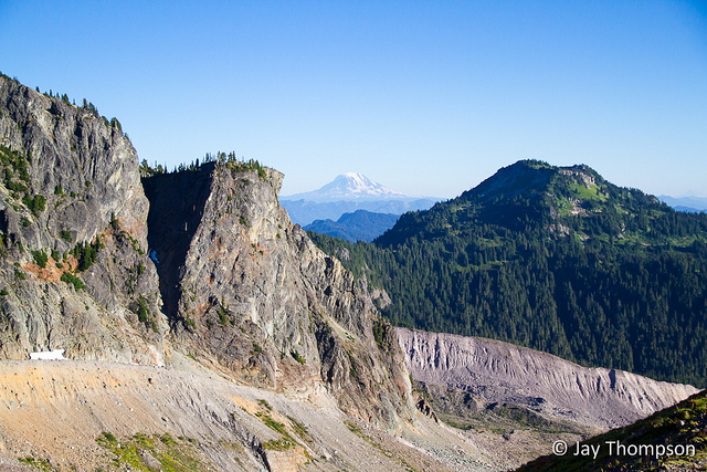
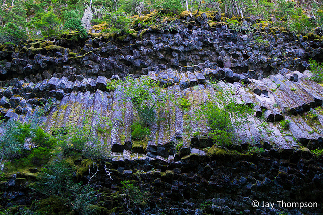
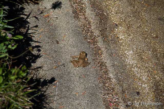
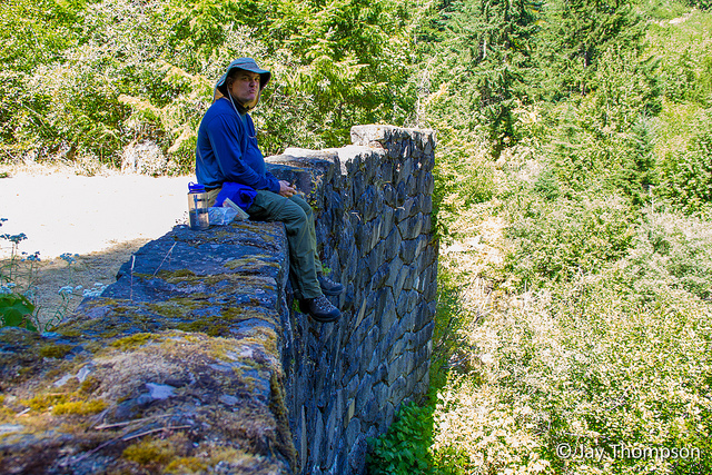
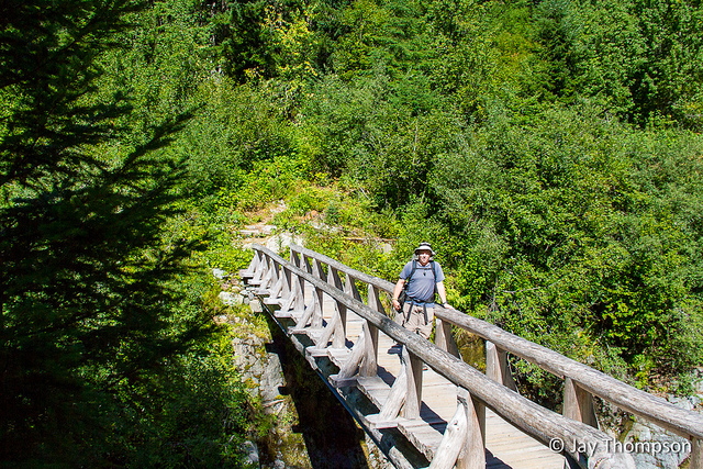
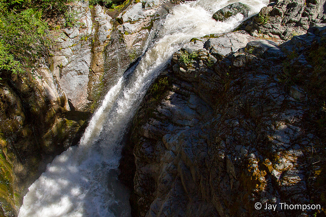
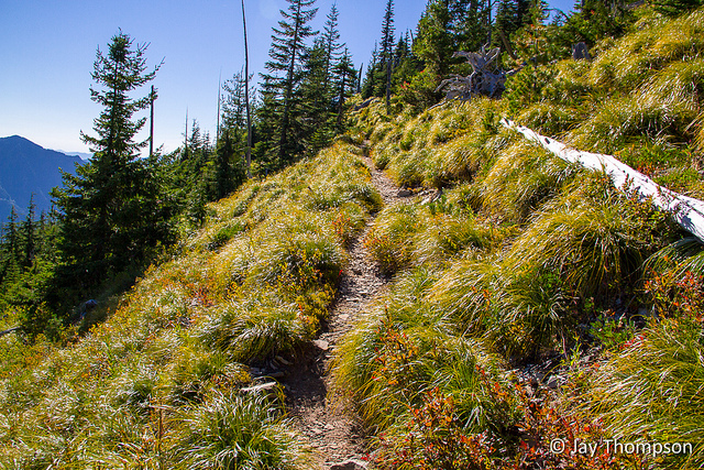
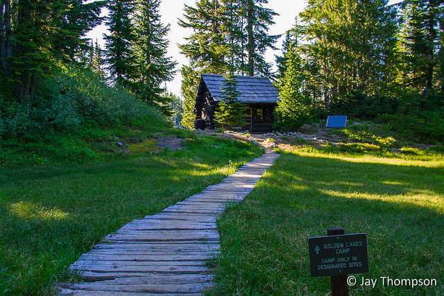
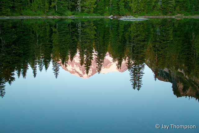
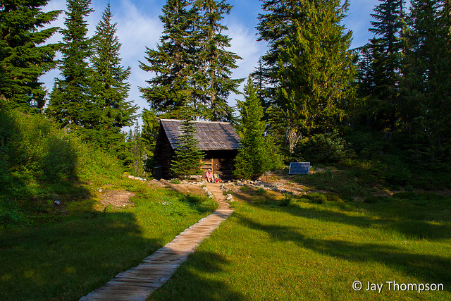
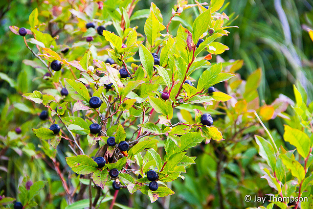
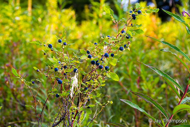
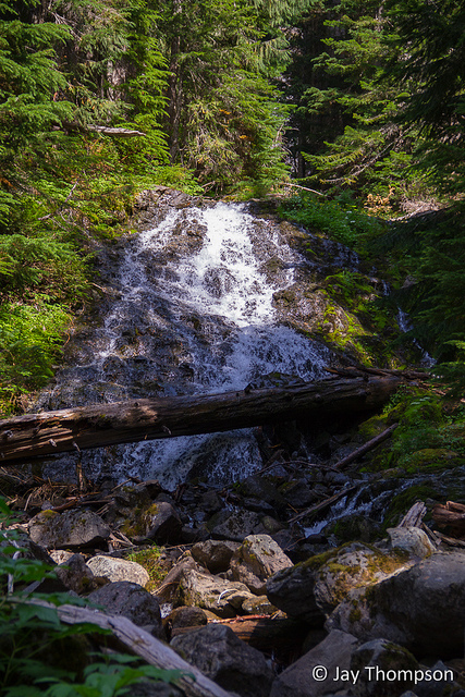
We made our first night's camp at the South Fork Puyallup River camp. I didn't take any camp photos but the next day I made a point to visit these columnar basalt formations just down the trail from camp.Pipe organ columner basalt. This was another excellent tip from my friend KathyThe South Fork Puyallup River.The trail going up into St Andrews ParkCheryl on the trailBeauty everywhere...St Andrews ParkYour's trulyThe beautiful St Andrews Lake. Tokaloo Spire can be seen just in front of Rainier.Though hard to tell in the picture, coming upon this chasm was very inpressive. We would eventually be making our way to the bottom before heading up the other side. In essence, that is what the entire Wonderland Trail is all about. Go up a ridge just to go down the other side to a river crossing and on to another ridge. A lot of ups and downs.I just liked this sign sitting amidst the flowers. This was near the beginning of Klapatche ParkPaul making his way into Klapatche ParkAt Aurora Lake, there were thousands of tadpoles in the water along the shoreline and some big frogs too.A small sample of the tadpoles along the shoreFeeling froggyAurora Lake reflection.Everywhere you turn on this trail there is some new beauty to behold.Heading down to the North Puyallup RiverOn reaching the North Puyallup River, we stopped for lunch. Here Paul is sitting on the old overlook at the river that is at the end of the West Side Road which has been abandoned.Looking up the North Fork Puyallup drainageOn the bridge crossing the North ForkWaterfall on the North Fork Puyallup from the footbridgeWaterfall and drainage of the North Fork Puyallup River from the footbridgeAfter crossing the North Fork Puyallup, the trail goes up through the forest and eventually comes out to an old burnt out area called Sunset Park.Funny how something so devastating such as a wildfire can clear an area and for it to recover so beautifully.Sunset Park was amazing and time to explore it further would be awesome. That ridge just begs to be explored. Another time perhaps.This was the first area for us to go through that had blueberries. We had seen lots of huckleberries but Sunset Park had tons of low lying blueberry bushes. They were very sweet.The meadows at Sunset Park went on and on. It was a truly beautiful place.Eventually we made it to Golden Lakes campThe patrol cabin was deserted. The only ranger we saw on the whole trip was way back at Indian Henrys.Golden Lakes were nice but at first we thought there were no views from there. After exploring the far side of the lake, we discovered that there was a nice view of the mountain.The reflection was very nice in the calm waters.
Day 3
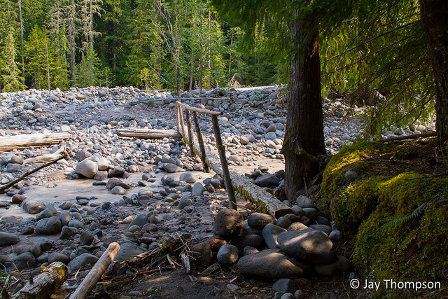
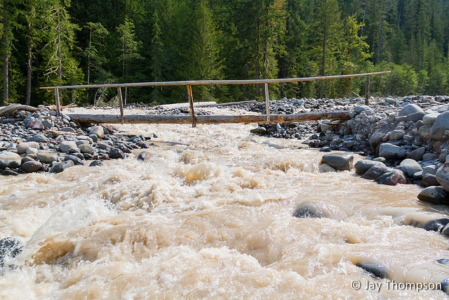
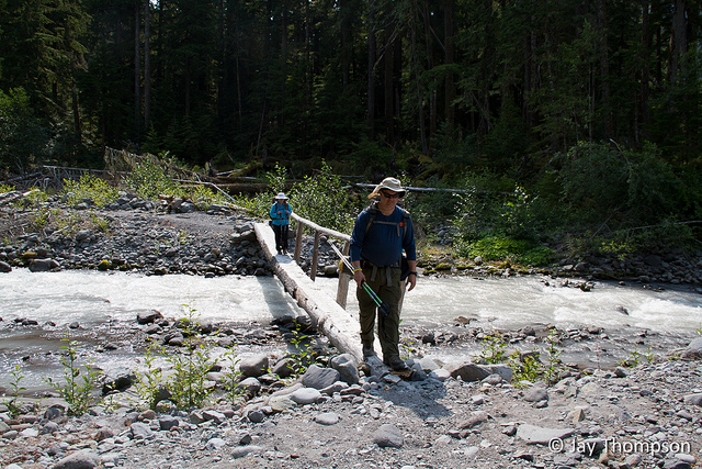
Once again I failed to get any shots of camp. It looked as if our final day was going to be another nice one.About a mile from camp we ran into huckleberry heaven.We probably wasted a good 45 minutes stopping to pick and eat huckleberries. They were soooo good! And plentiful.We finally made our way down to the final crossings of the day, the South and North Mowich rivers.South Mowich crossing.The South Mowich was a raging torrent. A fall in there would have ended badly.Just 4 miles and 2300 feet of elevation gain to go! This was near the Mowich River CampThis was our final crossing, the North Mowich River. The rest of the day would be all uphill to Mowich Lake and the parked vehicle that we dropped off a few days back.Lovely forested hillside on the way up to Mowich LakeI felt very tiny hiking through this section. The trees were tall and slender and it was very warm out. I was seriously looking forward to getting to the car but sad at the same time that my hike was coming to an end.Texture - These trees have a lot of character.The crossing of Crater Creek. This signaled that we were near Mowich Lake and the end of our hike. This was the last picture I took of our journey.
Hi Laurie! I’m glad you found me and got to see the report! I sure do envy you girls for being able to do the whole thing in one go. You should all be proud!
You can have any pictures you want. Just let me know which ones and I can send you the larger versions. My email is jaythom1@hotmail.com.
Many of the park ranger cabins have exterior storage cabinets. Most of them have animal cutouts in the cabinet doors. I’ve seen salmon, bobcats, buffalo, etc. Do you remember seeing the cabinet doors and their cutouts at the Golden Lakes Ranger Cabin? Maybe you have a photo? Thanks, -Jim
Hi Jim. Unfortunately I didn’t get any other pictures than what you see here on this page. Now that I know that, I’ll be on the lookout if I ever do the trail again.


Awesome journal and pics! I also got to relive some moments from Longmire to the suspension bridge. 🙂
Thank you Tess. I really missed not having you guys out there. Maybe next year for the other sections…
As always, gorgeous pictures!
Thanks Margaret!
For sure!!
You take the best pictures! I love them!
Thanks Cheryl. I can’t wait for parts 2 and 3!
Hey, Jay!
Remember us? Karen, Katie, & I were there! Love your photos! Any chance we could get a copy of a few for our scrapbooks?
Laurie
Hi Laurie! I’m glad you found me and got to see the report! I sure do envy you girls for being able to do the whole thing in one go. You should all be proud!
You can have any pictures you want. Just let me know which ones and I can send you the larger versions. My email is jaythom1@hotmail.com.
Talk to you later,
Jay
These are really lovely photos.
Many of the park ranger cabins have exterior storage cabinets. Most of them have animal cutouts in the cabinet doors. I’ve seen salmon, bobcats, buffalo, etc. Do you remember seeing the cabinet doors and their cutouts at the Golden Lakes Ranger Cabin? Maybe you have a photo? Thanks, -Jim
Hi Jim. Unfortunately I didn’t get any other pictures than what you see here on this page. Now that I know that, I’ll be on the lookout if I ever do the trail again.
Hi Jay! Thanks for the great blog posts. What time of year was this section of the hike done? Thanks!
Hi Jessica. At the top of the post it says Aug 26th, so we either started or ended right around that time.