Ahhh, the Loowit Trail. The Loowit trail goes around Mt Saint Helens. Its been on my to-do list for about 5 years now. I actually tried doing this trail about 4 years ago as a solo trip but I chickened out a few miles into it and turned around. This year, after a lot more experience under my belt, and knowledge that some good trail maintenance had been done on the trail, particularly around some recent washouts, I went for it.
After an early start, I drove the 3 hours to the trailhead. From reports I had read, and from a very knowledgable source on the subject, (you know who you are) I decided to start from the June Lake trailhead and go clockwise. My first day would be 13-14 miles and the second day about 20 miles. Due to the logistics of the trail, where water is located, and not being able to camp within the blast zone, this seemed to make the most sense.
Water was an issue on the first day. There was none to be found between Swift Creek and the Toutle River. I had 3 liters and wished I had more. It was hot. On the second day, just at the edge of the blast zone before going over Windy Pass, there is a great spring called Willow Springs where the water just gushes out of the side of the mountain pure and clean. When I went, there were a lot more water sources on the second day that there were on the first, although some of the sources were muddy with volcanic ash, water is water, and if I had to, I could have filtered it. I didn't have that option on the first day. There just wasn't any.
As always, click the images for a larger view with captions. Use left and right arrows on your keyboard to navigate or click the left/right arrows on either side of the image.
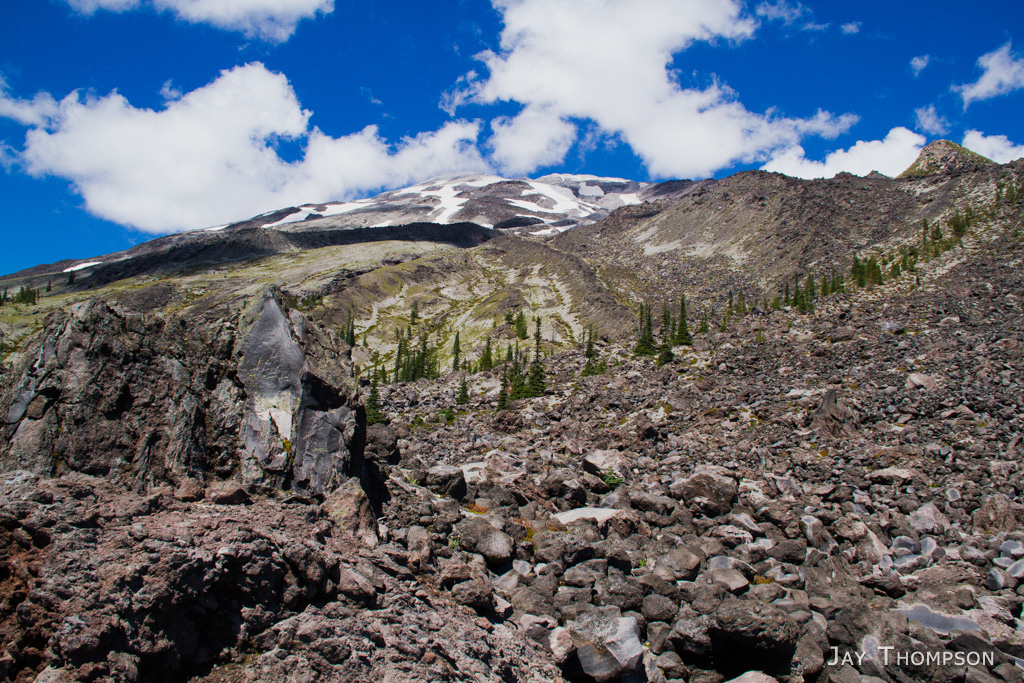
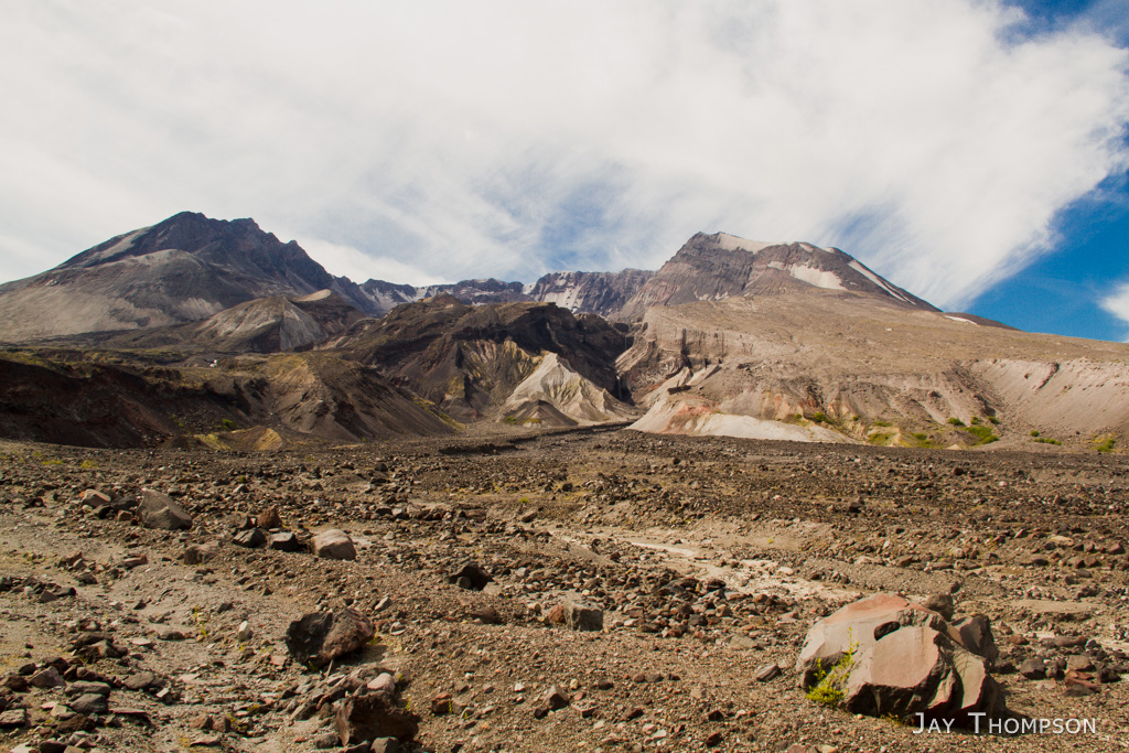
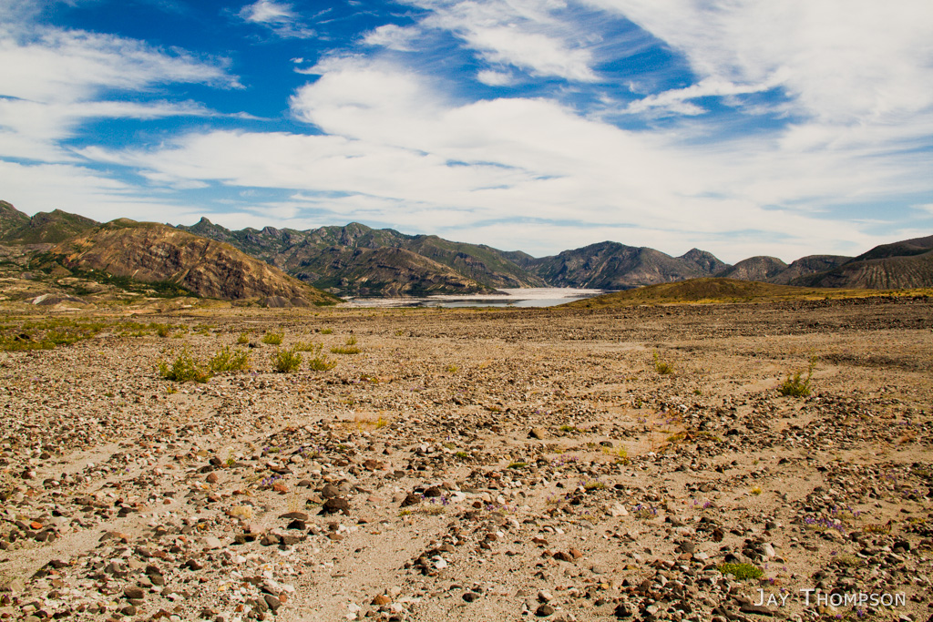
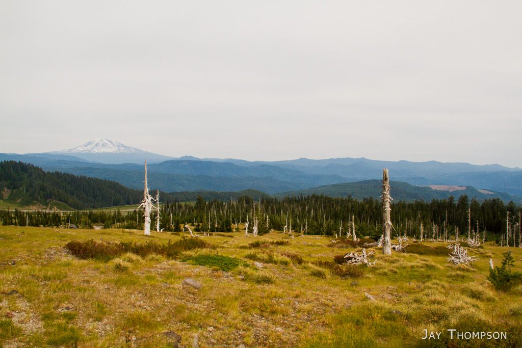
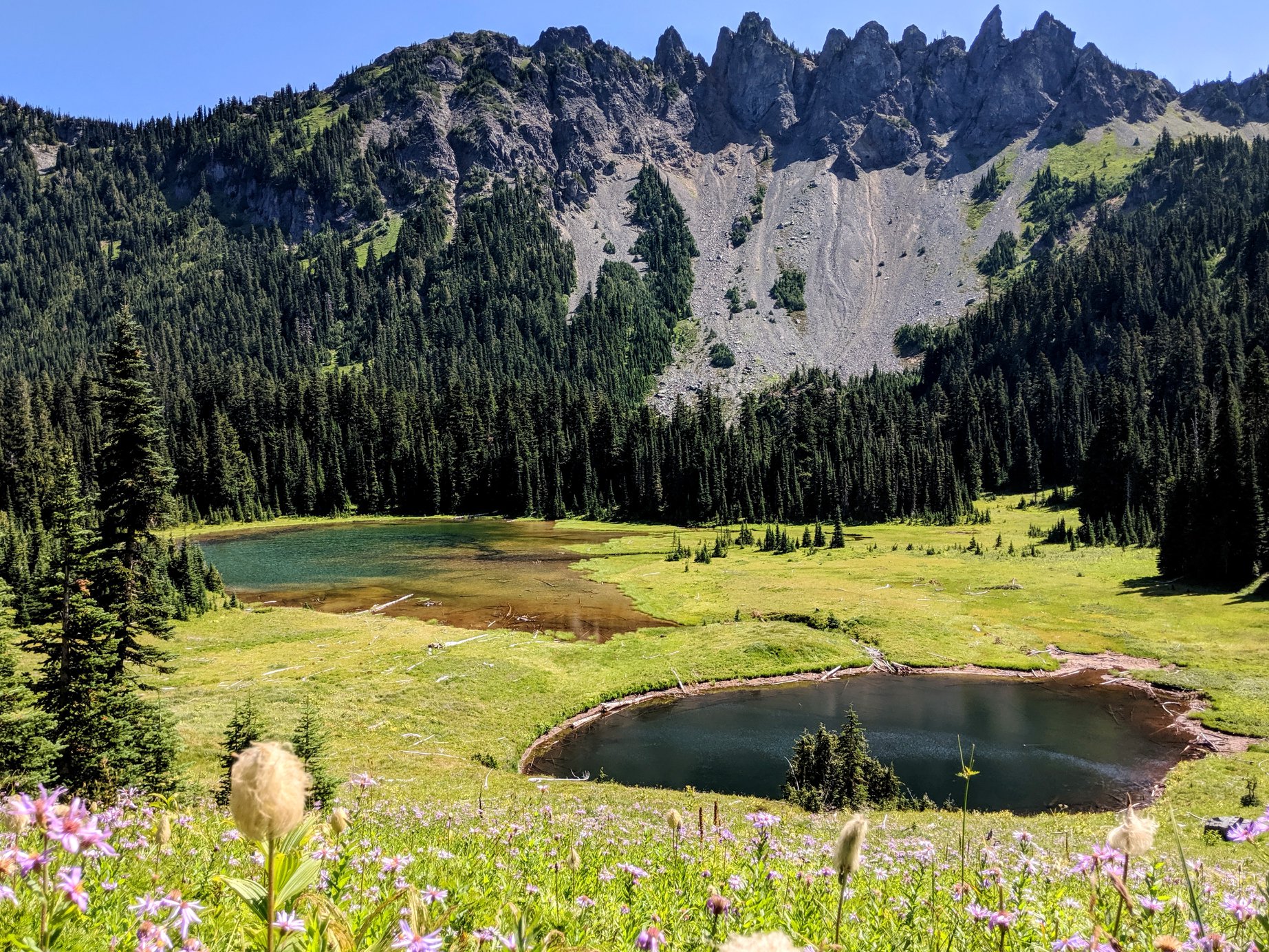
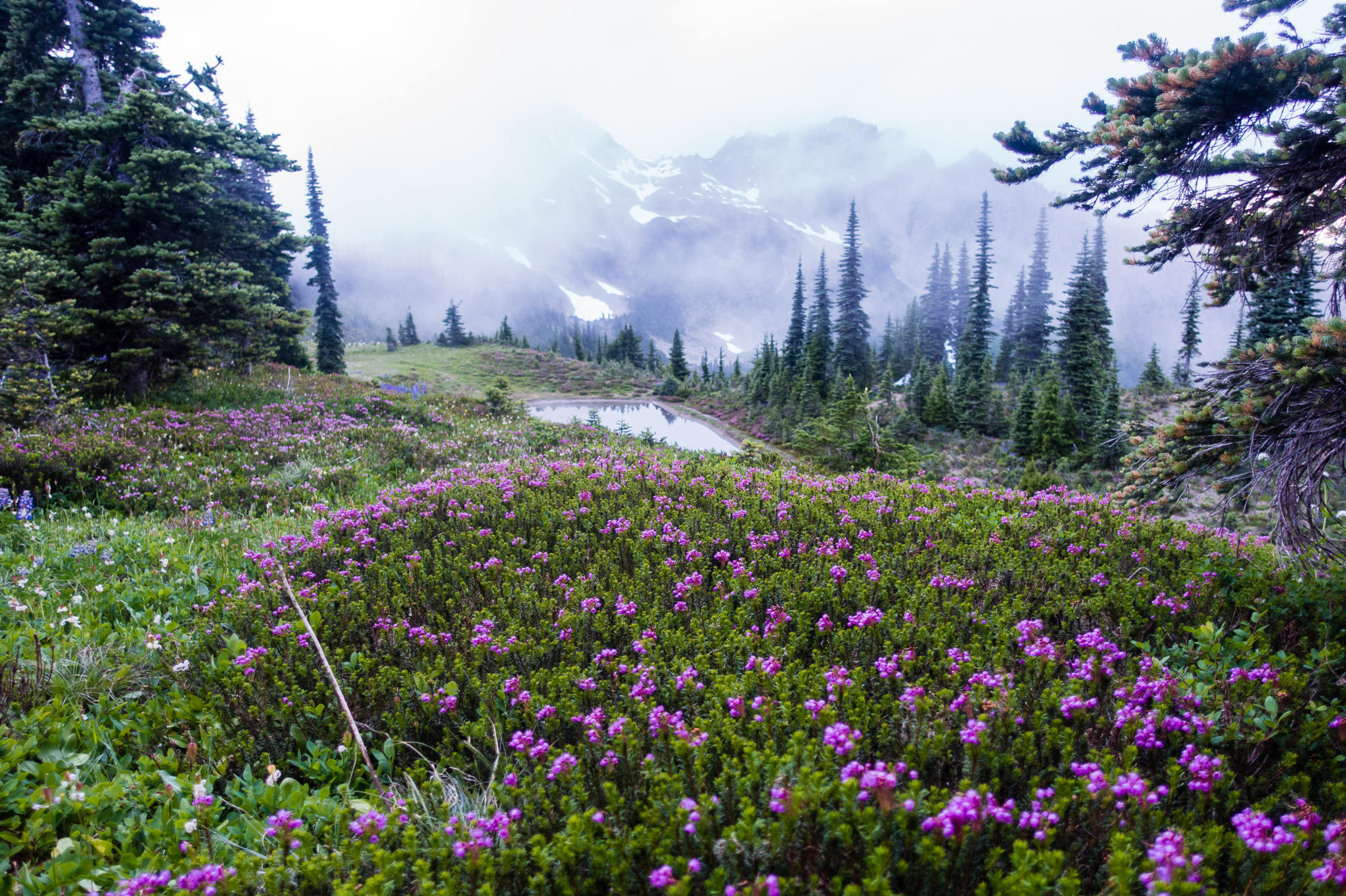
First view on the mountain from the June Lake TrailA not so great image of June Lake and waterfall.A minor lava field crossingThe first small washout to cross.This section of the lava field was easy. Mostly, the lava field was just hopping from one boulder to the next.Nice view of Mt HoodAnother big lava field.After the last big lava field from the last picture, you'll cross Swift Creek. You may recognize this area if you have climbed the mountain since this is the also the Ptarmigan Trail junction and access to Monitor Ridge.Swift Creek. Little did I know, this would be the last water I would see until I got to the Toutle River.Another lava field to cross.# 216Occasionally there were flowersThis is a huge washout that required a mile detour of the trail. You can see Goat Mountain across the way.What can I say? I just liked the yellow flowers.First view of the Toutle Canyon. Camp for the night (and some much needed water) was at the bottom.Bottom of the Toutle Canyon. You can get water out of the Toutle if you want, but it will likely be full of volcanic ash and mud. Your better choice is to take the Toutle Trail about a quarter of a mile to a fresher, clean flowing branch of the Toutle River. There is also a nice camp site here but it was occupied when I arrived. After I filled up on water for the evening and the next day, I backtracked to the canyon where there is ample room for camping. There were several tents spread out in the area, each having plenty of room and privacy. The next day would start with a climb up the big sandy side of the canyon pictured here.My camp site at the Toutle River.Toutle River that evening. No water crossings on this trip were very easy. Note the steep banks to get down to the water.Sunset on the mountain.The next day was a climb down the banks, and an easy ford of the Toutle, followed by a rope assisted climb out of the washout on the other side.This is a panorama from the climb out of the canyon. I made sure I got an early enough start to be in the shade for this climb.It was very sandy (ashy?) but the tread was not hard to walk on.Looking up at the mountain and the Toutle Canyon. It seemed to be in this constant state of a dusty haze, like the earth there is not ready to settle down.It didn't take long before I spotted some of the first elk of the trip.Herd of elk. Notice the eroding landscape. The little hills across the way are called hummocks and were part of the mountain before the eruption. Amazing to watch how they weather and erode over the years.Panorama of the blast zone. Johnston Ridge across the way. Mt Margaret Backcountry and Spirit Lake in the distance off to the right.Approaching views of the breachHard to imagine what happened here some 30 odd years ago.Not Loowit Falls, but another impressive set of falls coming out of the crater.Not Loowit Falls, but another impressive set of falls coming out of the crater.Torchered landscapeSpirit Lake and Mt Margaret Backcountry.The trail starts gaining elevation again at this point.Spirit Lake and Mt Margaret Backcountry with Rainier peeking into view.I'm not sure if it was just bad timing on my part or my expectations were too high but the flowers on this trip were few and far between. Compared to previous visits I've had to the Mt Margaret Backcountry, the flowers here were virtually nil. I was excited when there was something with some color to photograph.This is the climb up to Windy Pass. It looks way worse than it actually was.Windy PassLast look back from Windy Pass.Dropping down to the Plains of Abraham.Somewhere along the Plains of Abraham. There were a lot of mountain bikers in this area. I saw about 20 mountain bikers from several different groups here.Pumice Butte. Reminded me of Jabba the Hut.Looking up at the mountain from somewhere near the Ape Canyon Junction.Panorama of Mt Saint Helens and Pumice Butte very near the Ape Canyon junction..Looking back after crossing a washout. Pumice Butte on the right. Mt Rainier in the far distance. I had high hopes that the trail would be relatively easy once I got to the Plains of Abraham. While that area was flat and made for quick hiking, some of the worst washouts of the whole trail were still ahead, including the Muddy River and Shoestring Glacier washouts. Not only is the footing somewhat tricky on some of these washouts, they also require more elevation loss and gain. It seemed that you would just get out of one gully to find yourself facing another one.Another big washout.Mt Adams in the distance. At this point I had crossed the worst of the washouts and the trail was mostly downhill from here. I still had about 5 miles to go to get to the car. Being plenty tired, I didn't get many more pictures after this point. Honestly, there wasn't much worth taking a picture of from here on out. There was a big lava field that the trail skirts around and there is a really big spring you can see that just appears out of the ground near the June Lake Trail junction which ultimately feeds into June Lake. Other than that, just some lava rocks and forest.
This would prove to be one of my toughest days ever with an overnight pack. Almost 20 miles this day on difficult terrain and I still had a 3 hour drive home in front of me. But ahhhh, the cheeseburger on the way home would taste extra delicious.
Lovely photos once again Jay. Thank for taking me back. This is on my list to do again someday. Glad to see they put a rope on the Toutle Crossing. Good stuff.
Thanks for dropping by Jake. That rope was nice to have. It was getting a little frayed at the top so they’ll need to come up with something different soon. Craig R. told me he recommended to the monument folks to install a sand ladder for that washout. I hope they do that or maybe something a little more permanent.