I had the good fortune and privilege to hike with guidebook author, Craig Romano on the weekend of Sept 8th 2012. Craig is the author of several of the Day Hiking series Mountaineers books. We hiked the Mt Whittier "trail" in the Mt Margaret Backcountry of Mt Saint Helens. We also hiked the Lakes trail and some of the Boundary trail as part of the loop, but Whittier was what we were there for. Peder who I know from the Portland Hikers forum had hiked the trail a few times and was gracious enough to invite us along and show us the way. The Mt Whittier trail is not much of a trail, more a route really. The forest service gives it a black diamond status which we soon discovered was very appropriate. To be honest, I'm not really sure why the forest service advertises this as a trail at all as I found it to be quite dangerous in a few places. Route-finding skills are a definite must on this one. Fortunately we had Peder as our guide and Craig mapped the entire thing for Green Trails Maps. Future versions of the map for this area should include the new data. The trail depicted on the current map is incorrect as there has been a reroute due to a washout.
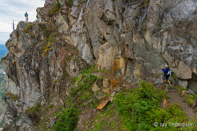
Steep Difficult Trail Ahead!
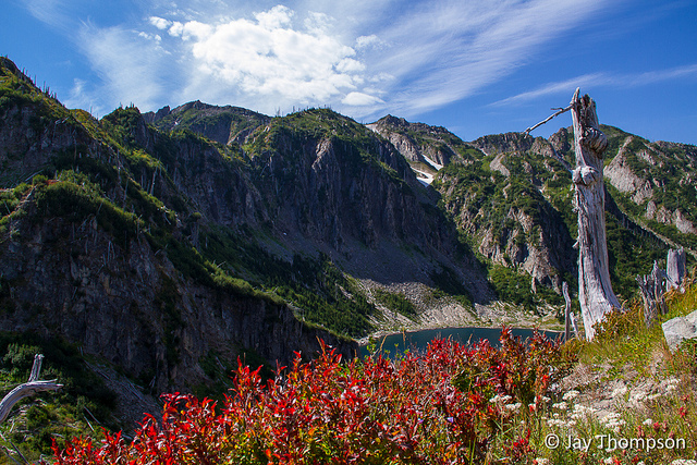
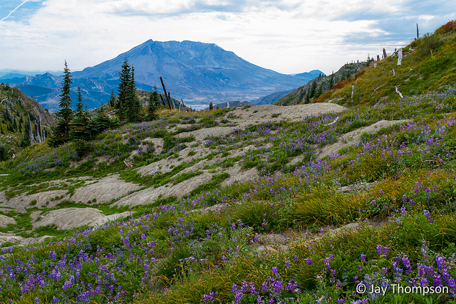
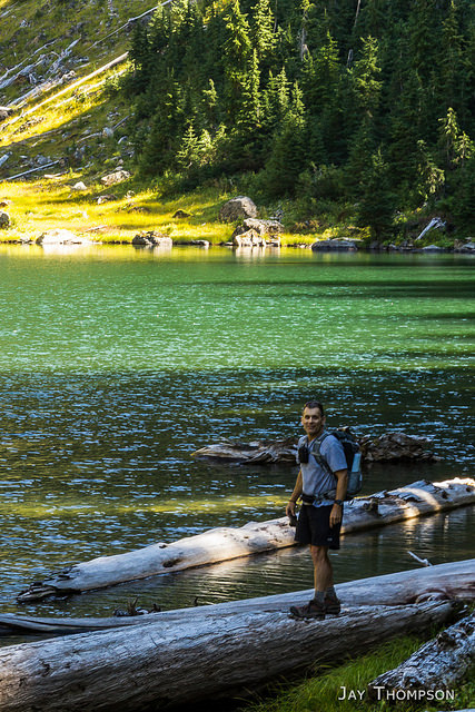
Saint Helens from Norway Pass
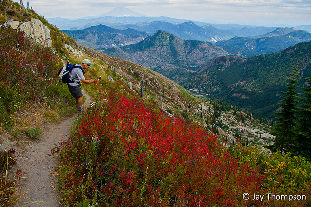
The trail from the Norway Pass Trailhead is uphill all the way to Bear Pass. It then drops down to Grizzly lake and goes up and down in elevation until the Mt Whittier Trail. You hardly notice the elevation gain on this hike, as you witness wide open views the whole day.
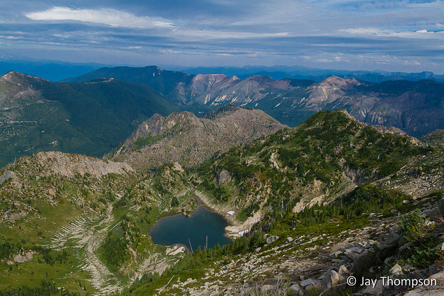
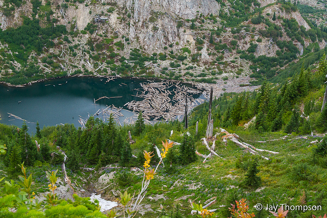
Grizzly Lake
Elk tracks
Skittish elk. It was well within its rights to be skittish as bow season had just opened.
Peder and I hiked on ahead at this point while Craig mapped all the campsites at Obscurity Lake.
Looking back at Obscurity Lake
First View of Panhandle Lake. We met three ladies on the trail that camped here overnight. They really enjoyed it and had the place all to themselves. When we talked to them, Craig explained that he was going down to the campsite to map it and that he was working for Green Trails. He also said he was a guidebook author at which point I blurted out "This is Craig Romano"! The ladies were thrilled to meet him and explained they got the idea to camp here from his book Backpacking Washington, hike #15 Mt Margaret Backcountry Lakes. Craig says this is the best camp on the Lakes Trail.
Looking back at Panhandle Lake
Craig taking pictures
Shovel Lake and first views of Mt Whittier
Shovel Lake Trail. Peder and I waited here and ate some lunch while Craig hiked down this trail to record it with his GPS. He complained about this trail the whole rest of the day, LOL. The trail disappears about half way down and was very dusty he said. We weren't sure if there was a camp down there or not but if there was, he couldn't find it.
Mt Whittier. The trail leaves the lakes trail and starts climbing up the shoulder of the mountain on the right of the picture. It was very steep
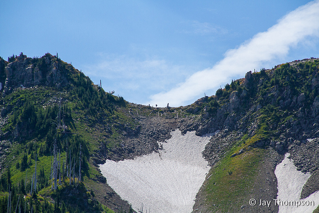
There was a group in front of us that was already doing the traverse. During lunch we occasionally heard voices drifting down and when we looked up we could see these folks on the ridge. They kept going back and forth like they didn't know where to go. Peder said the route in the area they were in was a little hard to follow. You can just make out one of the hikers in the middle of the saddle.
Across the valley I spotted an Elk, or maybe Peder spotted it, I can't remember. I zoomed and took photos. Later, when I was processing the images I discovered there were two elk. They were watching Craig as he made his way down to Shovel Lake. Can you spot them?
Finally, the Whittier "trail"
Craig being funny
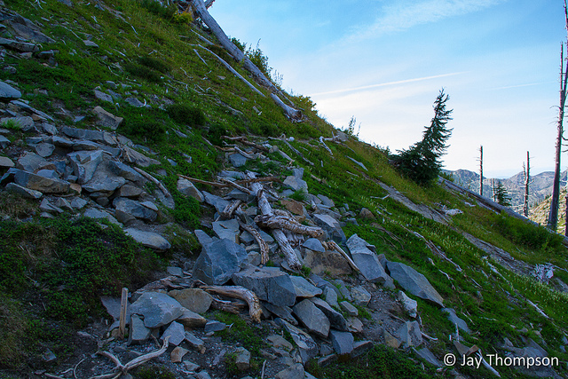
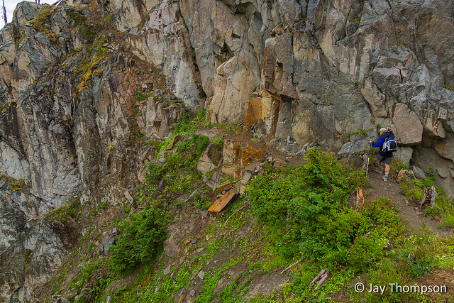
The trail had been closed for a few years due to a washout. This is the old section near the washout that has now been abandoned.
Shovel Lake below. Craig was still talking about his hike down there.
Craig taking notes at the beginning of the ridge walk
Peder pointing out the trail that follows the ridge to the top of Whittier
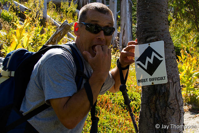
You want me to go where!!!! Ah ha ha ha ha ha! You're kidding right?
If you look real close in the center of the picture, you can see the group that was ahead of us. They finally figured out the correct route (more or less) and were starting to make progress.
"Come on Jay, it's not that steep!"
"Really it's not!" It was at this point that I was really wishing I had brought some hiking poles
It doesn't look too bad in this photo but this was the first somewhat sketchy section.
This is looking back at the section in the previous picture. You can just make out the trail in the upper right hand corner. Craig is asking, "Where is the trail"?
More ridge walking in a less exposed section.
Guidebook author in action
We spied a couple of mountain goats. This was quite a surprise. I didn't expect to see goats up here.
Goats and the summit of Whittier.
Peder leading the way
One of the heart pounding spots. Photo by Craig Romano
Peder waiting patiently as Craig and I gawk and take pictures
Holmstedt Lake
Approaching the top. Photo by Craig Romano
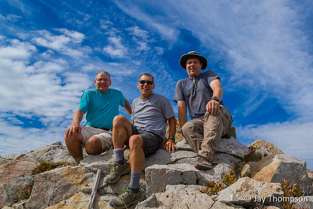
Peder, Craig and myself on the Mt Whittier summit.
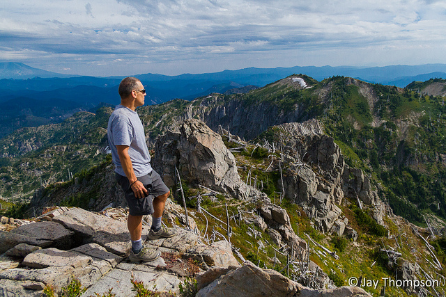
Craig contemplating the rest of the hike
Peder on the Whittier Summit.
Leaving the summit. Photo by Craig Romano
Peder leading the way though the last sketchy section
Just...
Craig's turn.
I forgot to mention it earlier but a rain cloud moved in just before we got to this spot making the trail and rocks wet and slick.
Luckily, it wasn't nearly as bad as it looks
My turn.... gulp!
Phewww! done with that part. Here is looking back. Not so bad
Although past the worst of it, the drop-off was still kind of hairy.
Looking out at the rain cloud that got us
Never go in those cool looking ice caves in case something like this happens
Peder scoping Boot Lake
Looking back at the traverse
Ahhh!
Back on good trail!
Saint Helens from the Boundary trail
A look back at Mt Whittier. If you look closely you can see an arch Peder called the cannon hole just to the left of the summit.
A look down at Grizzly lake from the Boundary trail
Craig capturing the fall colors
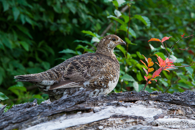
This grouse refused to move which gave us a great opportunity to take it's picture
Fall fast approaching
On my drive home, I was rewarded with this sunset. It was simply a fantastic day.[/caption]
The Mt Whittier trail (No. 214) is located in the Mt Margaret Backcountry of the Mt Saint Helens National Monument. At 5883 feet, Mt Whittier is second in height in the Monument only to Saint Helens itself. You can access the Mt Whittier Trail from either the Lakes Trail (No. 211) or the Boundary trail (No. 1). The Norway Pass trailhead on Forest Road 26 is the closest access point to Whittier but a longer approach can be done from the Coldwater Lake side of the Lakes Trail off of Hwy 504. There are often large snow patches on steep terrain until well into late summer that require extreme caution to traverse making the trail even more potentially dangerous.
“Across the valley I spotted an Elk, or maybe Peder spotted it, I can’t remember. I zoomed and took photos. Later, when I was processing the images I discovered there were two elk. ”
You spotted the one elk – and subsequently a second one! It is amazing how well they blend in with their surroundings. Two years ago I took a picture of about 50 elks on the mudflats below the west side of Mt Whittier; and when putting the picture through Photoshop, I saw that there was a bull elk quite close to me. I completely missed this elk while sitting on the summit looking around for about an hour…
I hope that Craig does NOT put the Whittier trail # 214 on the on the Green Trails Maps. This is not a trail suited for the average hiker. This was demonstrated by the three people ahead of us who (I am sure) scared themselves silly.
Yes what do you do? On one hand, you and I both know this trail is not well suited for most folks. On the other, the forest service has deemed this to be an official trail. Do you give people the means to help find their way (which is what the map is for) or do you denounce the trail altogether? People are funny when it comes to the warnings. Some, like me I suppose, are attracted by the warnings and difficulty. I don’t have an easy answer, but I’m guessing Craig doesn’t get a say in whether the trail shows up on the map or not as this would be Green Trail’s call. Any book he may or may not write about the area will be his call however and I bet if he includes Whittier, there will be warnings aplenty. Personally, I think the forest service either needs to dramatically improve the trail so it is better suited for the common hiker or abandon it altogether and let it remain as an unmaintained route. That’s my thought on the matter. Thanks again for inviting us along Peder. I may try to join you next spring for some hiking in the Gorge.
As previously mentioned I really enjoyed seeing your pictures from this hike – the captions and additional information are icing on the cake. Nice work, Jay!
Thanks Kelsie. Its a really unique hike. I’m glad you enjoyed the report. If you haven’t been down to MSH, you should really try it sometime. Especially the Mount Margaret Backcountry. It’s become one of my favorite areas to hike.


With Peder Bisbjerg and Craig Romano
Some good shots here buddy.
Thanks Jake!
really nice jay!
Awesome post. Enjoyed your hike pics!
Thanks Keenan. You have a pretty nice website yourself. Love the Aspens. We don’t have a lot of those in my area.
Thanks Kathy
“Across the valley I spotted an Elk, or maybe Peder spotted it, I can’t remember. I zoomed and took photos. Later, when I was processing the images I discovered there were two elk. ”
You spotted the one elk – and subsequently a second one! It is amazing how well they blend in with their surroundings. Two years ago I took a picture of about 50 elks on the mudflats below the west side of Mt Whittier; and when putting the picture through Photoshop, I saw that there was a bull elk quite close to me. I completely missed this elk while sitting on the summit looking around for about an hour…
I hope that Craig does NOT put the Whittier trail # 214 on the on the Green Trails Maps. This is not a trail suited for the average hiker. This was demonstrated by the three people ahead of us who (I am sure) scared themselves silly.
Yes what do you do? On one hand, you and I both know this trail is not well suited for most folks. On the other, the forest service has deemed this to be an official trail. Do you give people the means to help find their way (which is what the map is for) or do you denounce the trail altogether? People are funny when it comes to the warnings. Some, like me I suppose, are attracted by the warnings and difficulty. I don’t have an easy answer, but I’m guessing Craig doesn’t get a say in whether the trail shows up on the map or not as this would be Green Trail’s call. Any book he may or may not write about the area will be his call however and I bet if he includes Whittier, there will be warnings aplenty. Personally, I think the forest service either needs to dramatically improve the trail so it is better suited for the common hiker or abandon it altogether and let it remain as an unmaintained route. That’s my thought on the matter. Thanks again for inviting us along Peder. I may try to join you next spring for some hiking in the Gorge.
As previously mentioned I really enjoyed seeing your pictures from this hike – the captions and additional information are icing on the cake. Nice work, Jay!
Thanks Kelsie. Its a really unique hike. I’m glad you enjoyed the report. If you haven’t been down to MSH, you should really try it sometime. Especially the Mount Margaret Backcountry. It’s become one of my favorite areas to hike.
Beautiful pics and story lines… on my list for next summer. – Thanks!
Another one on my bucket list!