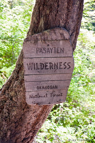
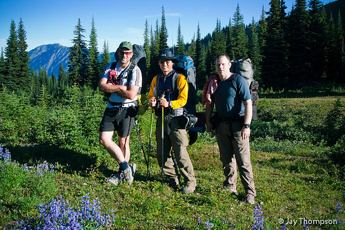
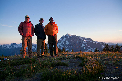
On Labor Day weekend this year, I co-hosted a backpacking trip around Jack Mountain in the North Cascades / Pasayten Wilderness with fellow PWC club member Kevin Koski. Joining us on the trip was another friend and club member, Isaac Sun. Originally another group of people from Hawaii that saw the trip announcement on-line was going to join us but due to a work conflict, they pulled out at the last minute.
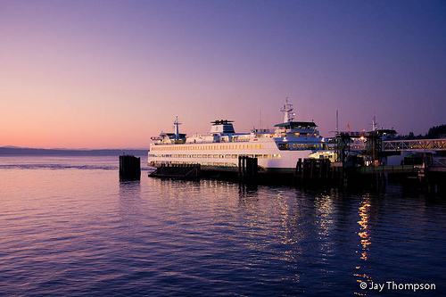
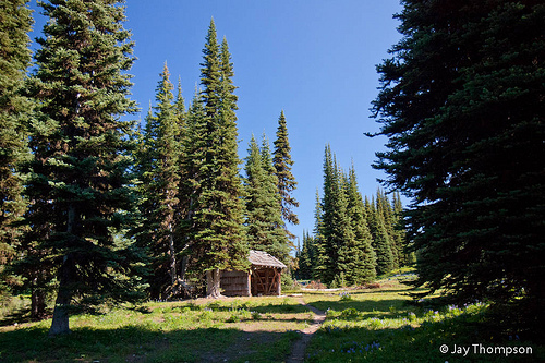
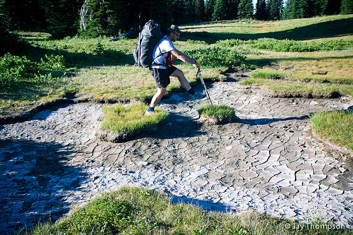
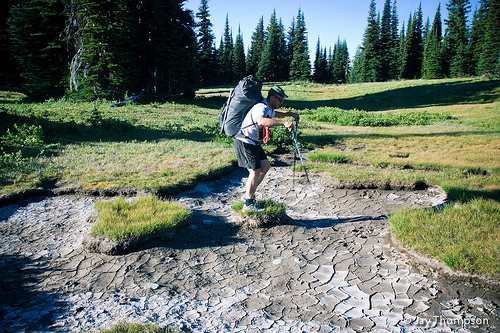
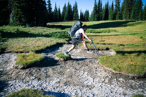
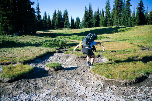
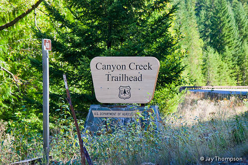
The plan was to hike 4 days utilizing the Labor day weekend. We decided we would end the hike on the Tuesday after Labor Day so we could avoid the post holiday traffic on the road driving home. Kevin got an early start and hit the road the night before and slept at the trailhead. The next morning he got up early and headed up the trail to Crater Lake and one of the old lookout sights on Crater Mountain. Later we found out that he also summited Crater Mountain and had one of his biggest elevation days ever with 8500+ feet of gain for the day. Isaac and me were on a dramatically more leisurely pace. We caught the 6:25 Kingston ferry on Saturday morning and got to the Canyon Creek trailhead at around 10:00. Our first day consisted of about 8 miles and 4700' of elevation gain. We hiked up to the junction of the Crater Lake trail and on through McMillan Park where the mosquitoes started getting bad. There was a lot of places there with standing water and there wasn't much of a breeze so we didn't linger for long. After McMillan Park, the trail dips down a couple hundred feet just before the final push for the day at Devil's Park. This was probably the hardest part of the day as the trail got a little steeper and it was also getting hot out. The first thing you see when entering Devil's Park is the nice shelter there. The whole Devil's Park area is a nice and flat sub-alpine area. Lots of good hardened camp spots. Lots of spots you could just pitch a tent and stealth camp if you wanted to also.


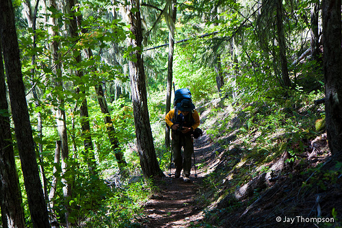

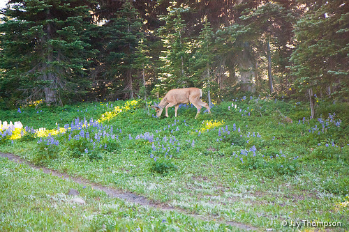
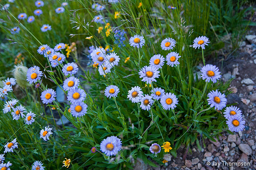
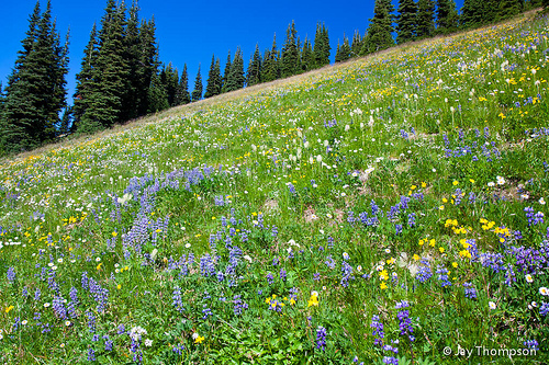
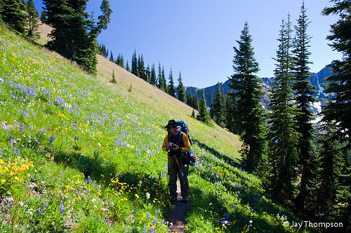
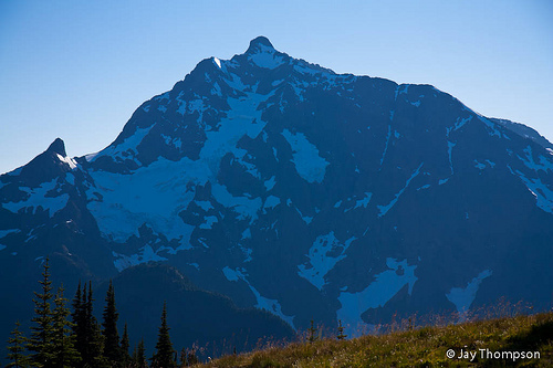
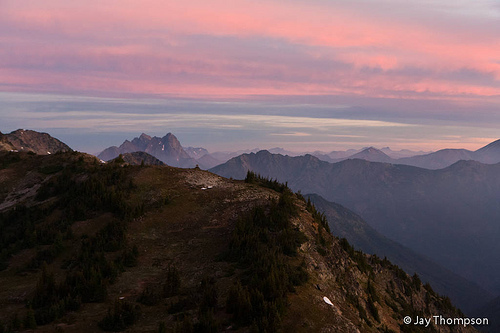
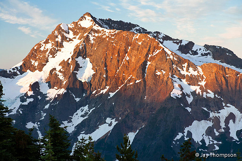
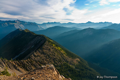
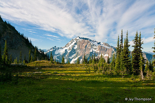
The next morning we got up and headed out of camp at a reasonable hour. Leaving Devils Park, the trail continued to climb, now alongside Jackita Ridge. After we climbed about 2 or 3 hundred feet above Devils Park, the wildflowers along the trail became profuse. Up to this point there was not a lot to talk about in the flora department except for a few small patches at Devils Park. The flowers along the trail, along with the ever-expanding views of the North Cascades, Crater Mountain, Jerry Lakes and Jack Mt were the highlights of the day.


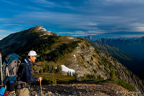
When we arrived at the part of the trail nearest Point 7248 (the area labeled bad for stock on the map), Kevin and Isaac decided to summit it. I bowed out of this plan as I wanted to conserve my energy for the rest of the hike and indeed I was already pretty tired. The plan was for them to summit 7248 and then follow the ridgeline over to 7350 also know as Jackita Mt, and then drop back down to the trail. I went ahead and hiked slowly watching them when I could see them. The "not suitable for stock" section of the trail was pretty steep switchbacks and included a short icy snow section to cross. I brought my ice axe along in anticipation of this section but it really wasn't needed much as there were good steps in the snow to follow. For extra traction, I picked up several handfuls of dirt and threw it on the icy steps before committing to cross it. I paused a few times more to watch Kevin and Isaac traverse across the ridge before heading off to our rendezvous point which was a steep ridgeline coming down from 7350.
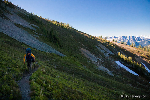
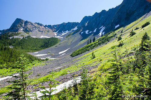
Once we were all back together, we commenced hiking again. The next part of the trail went around a large cirque and there was a stream crossing and a nice little camp site. We paused here only long enough for a quick snack before moving on. The bugs were pretty ferocious here. As the trail contoured around the cirque it first went down a few hundred feet, followed by regaining the elevation lost on the other side of the stream crossing. Eventually we came to another ridge and crossed over where the trail began a very steep descent. We were entering into the headwaters of Devil's creek, another large cirque but one with steep walls and big snow patches that the trail descended to avoid. We dropped a thousand feet of elevation and regained the same thousand feet within about a mile and a half. To me, this was the hardest part of the entire day. After the ups and downs we already encountered this day, plus the 4700 feet of gain the day before, I was wiped! The trail was beginning to live up to its being named Devil. After we got through this brutal stretch, the trail became very gentle and contoured the mountainside on a mostly level grade until we reached Devils Pass where we filled up with water from a nearby spring. We were coming up on the home stretch with the final 800 feet or so of elevation gain for the day.

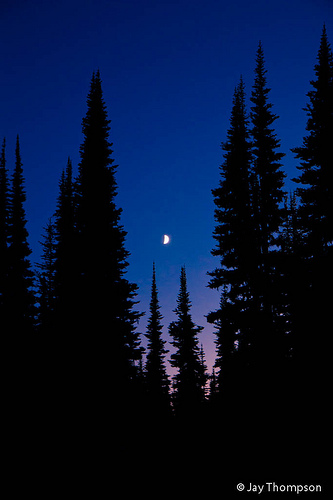
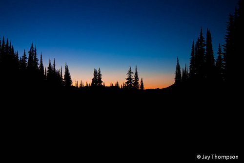
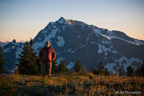
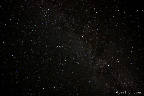
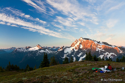
The going was pretty slow for me. Kevin seemed to still be in high gear and Isaac was lagging the worst I have ever seen him. He is usually faster and stronger than me on the trail but probably due to his heavy pack and following Kevin on their little ridge walk earlier in the day, he was pretty tired. We eventually made it though after 14 miles for the day and around 4000 feet of total elevation gain. Devil's Dome was pretty nice. Some folks already had the choice spot on the summit so we found a relatively flat spot nearby and flopped our gear down. Kevin and I made the decision to sleep under the stars while Isaac pitched his tent. We encountered no dew the night before so we anticipated another dry night. After dinner and watching the sunset, we called it a night. I remember waking around 2 in the morning and watching the stars. If you have never slept out in the open under the stars on a mountain top, I highly recommend it.
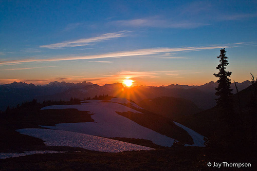
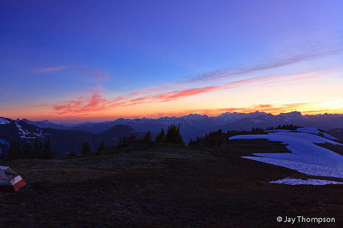
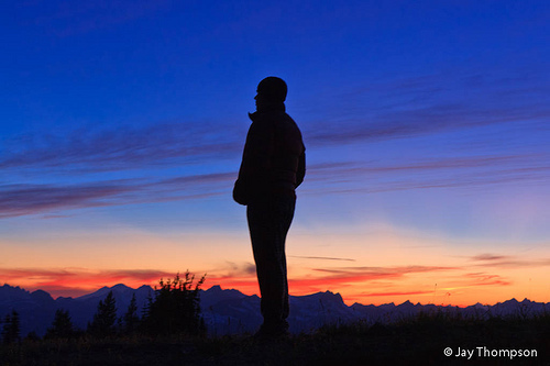
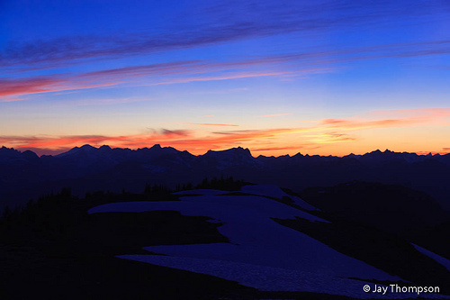
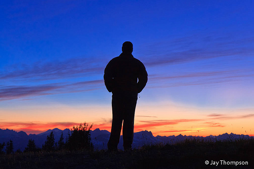
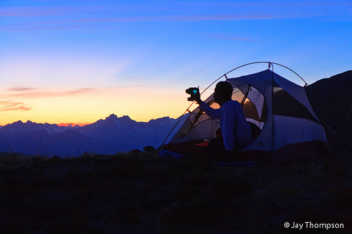

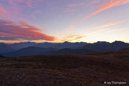
Around 5:30 Kevin woke me let me know the sun was coming up. I didn't want to wake up but am glad I did since the sunrise was one of the best I've ever seen.


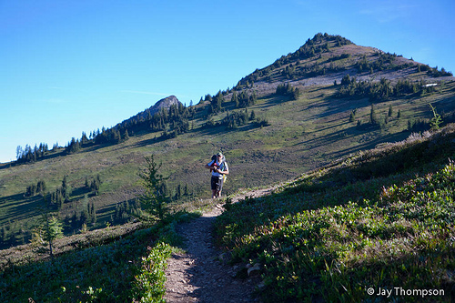
For some reason we were all in a hurry to get our day started and to hit the trail. Kevin was going to go off by himself for a bit and bag a couple more summits. Isaac wanted to go with him but I convinced him this time to stick with me. We had a 6 mile long 5000 foot descent to look forward to with it being about 9 miles to our next camp.


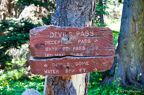
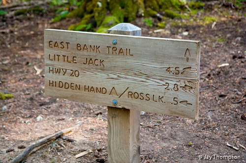
After our long descent to Ross Lake, we stopped at the Devils Junction boat camp. We had stopped to take pictures of some trail signs and somehow missed the turn on the East Bank trail. The folks that had camped on the summit of Devils Dome came by and offered us a ride in the water taxi that they had booked. I told them thanks but no because we had to wait for Kevin. I would have totally taken them up on the offer if Kevin was there.

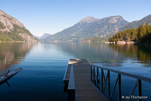
Around 1:30 we made it to our final camp site at Rainbow Point which is about 3 miles from Devils Junction. It was very warm at the lake. After securing my pack in one of the large bear boxes, I took a 30 minute nap on one of the picnic benches at our camp spot. It was a really good rejuvenating kind of nap as I was still tired from the night before from watching the stars. Kevin eventually arrived and persuaded us to go swimming. I didn't so much swim as take a bath. Surprising how much funk you can wash off in a freezing cold lake. Actually I've been in colder, but you know, cold is cold. It was very refreshing to say the least,especially considering how warm out it was. So after dinner and watching the sun go down we once again called it a night.

For the final day we had a 13 mile hike to look forward to with a 1000 foot of gain to get over Hidden Hand Pass. Isaac I have learned doesn't sleep much at night. We had agreed the night before to try to get an early start and an early start is exactly what we got with a 5 am wake up from Isaac. This put us on the trail by 6 am. I assumed the final stretch of trail would contour along the edge of the lake but after it climbed the hillside away from the lake shortly after leaving camp, we hardly saw it again for the rest of the hike out. The trail was pretty flat except for the climb over Hidden Hand Pass and even that was a fairly gradual ascent. The miles went quickly and we got our 10 by 10. 10 by 10 is a thru hiker saying meaning we hiked 10 miles by 10 am. At the rate we were going we could have easily got 20 by 2:00 if there had been enough trail. We hit 10 miles at 9:45. Only 3 miles left and we were at our cars by 10:45.
This was an extremely rewarding backpacking trip and I highly recommend it... except for the uphill parts!
Stats for the trip: 43 miles and a little more than 10,000 feet of elevation gain.
To read Isaac's trip report click here.

I finally got around to reading your report Jay.
Great report and pictures. You guys had some really nice weather.
Thanks for sharing
Thanks Craig. It was a wonderful outing. We couldn’t have asked for better weather.
Jay
Pingback: Devil’s Dome Loop – Washington – The Traveling Thomases