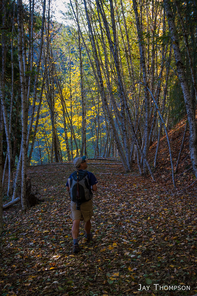
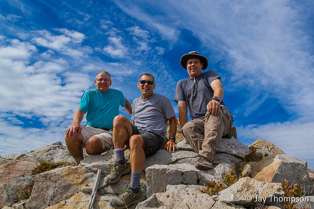
I once again had the pleasure of hiking a somewhat obscure route in the Mt Saint Helens area with guidebook author, Craig Romano. Craig is in the process of hiking all the trails in the Mount Saint Helens National Volcanic Monument as research for a new book he is writing. I am honored to accompany him on some of these hikes as he finishes up his research in an area that is near and dear to my heart.
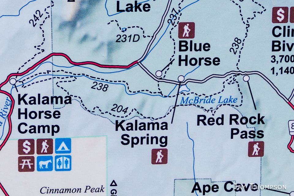
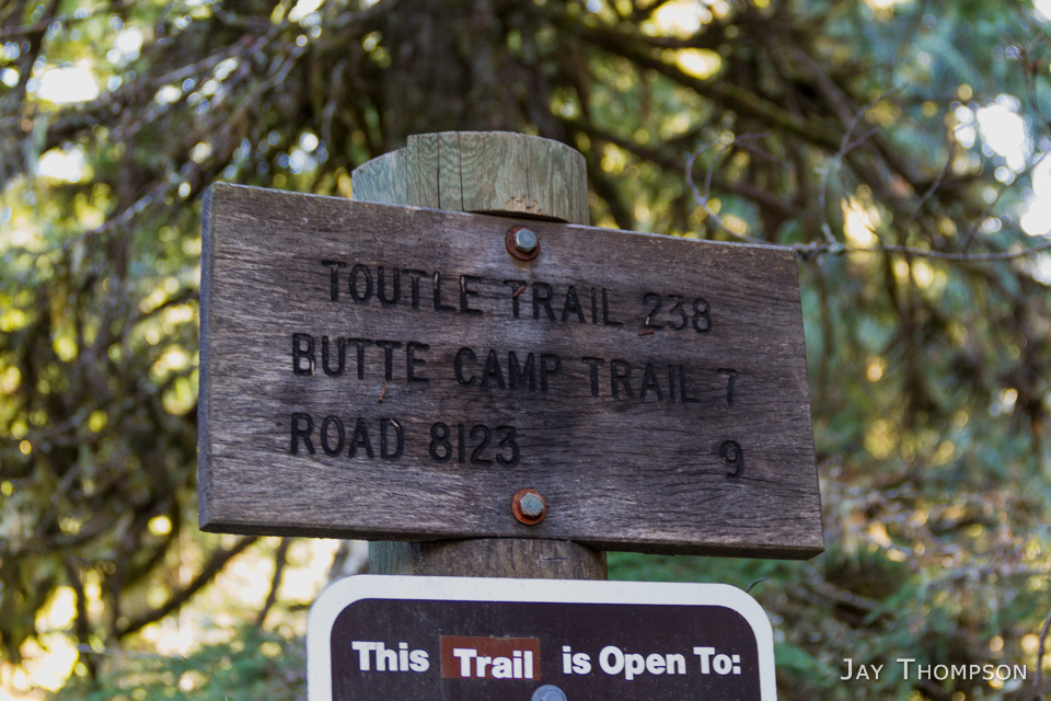
The Cinnamon Trail (trail #204) lies SW of Mt Saint Helens and runs along a ridge (we'll just call it Cinnamon Ridge) that parallels the Kalama River for a spell. We picked up the trail from near the Kalama Horse Camp just off of the Toutle Trail (#238) and followed it east, to its end at Red Rock Pass and another junction with the Toutle Trail. The ridge is the dividing line for the monument boundary. The trail stays near the 3700 foot level as it follows this invisible border, topping out around the 4000 foot level in one spot. Once we got to Red Rock Pass, we turned to the west and followed the Toutle Trail back to where we left my car at the Blue Horse Trailhead (#237). Returning to the starting point of the hike as a longer loop was an option, but we decided that due to the short amount of daylight, and our uncertainty of snow conditions on the ridgeline, that the shorter loop would be the better way to go.
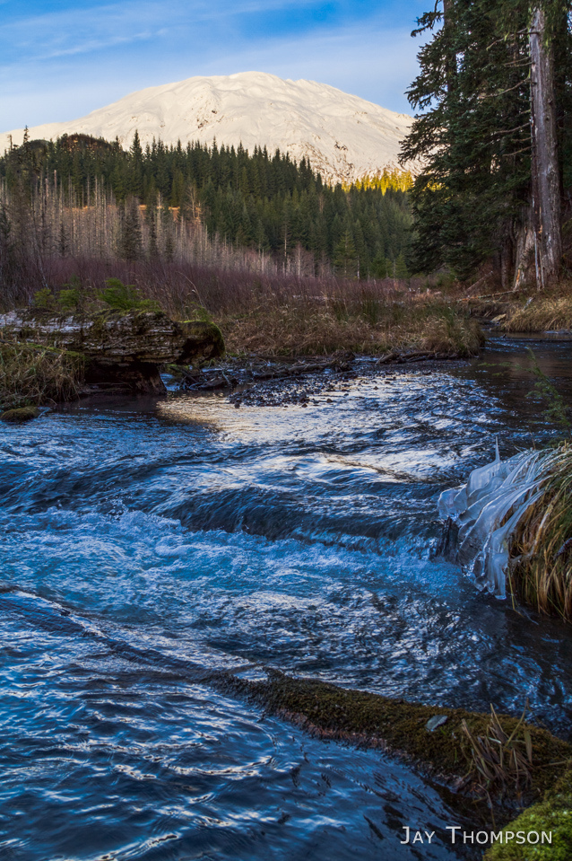
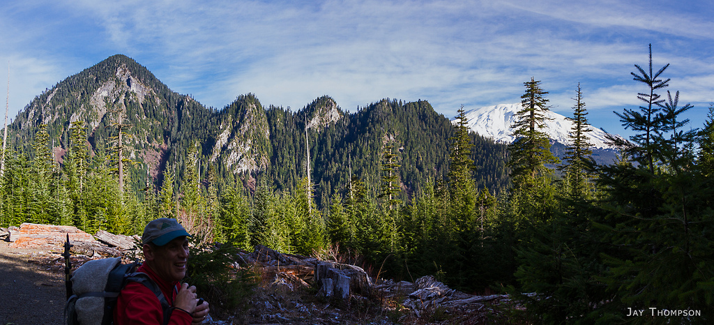
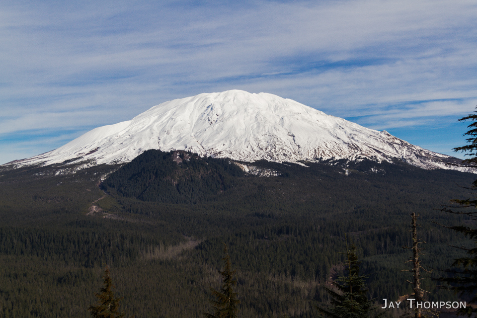
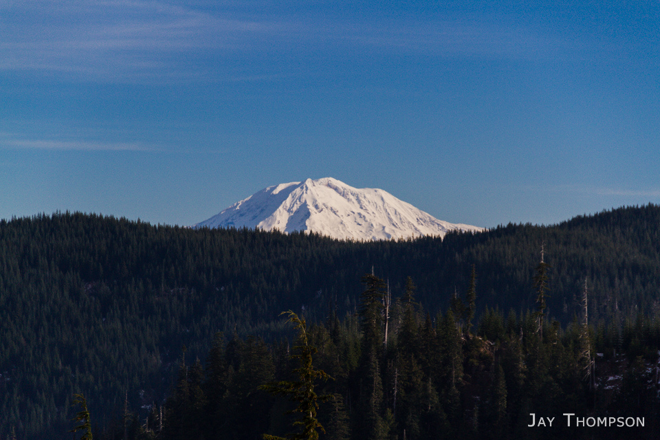
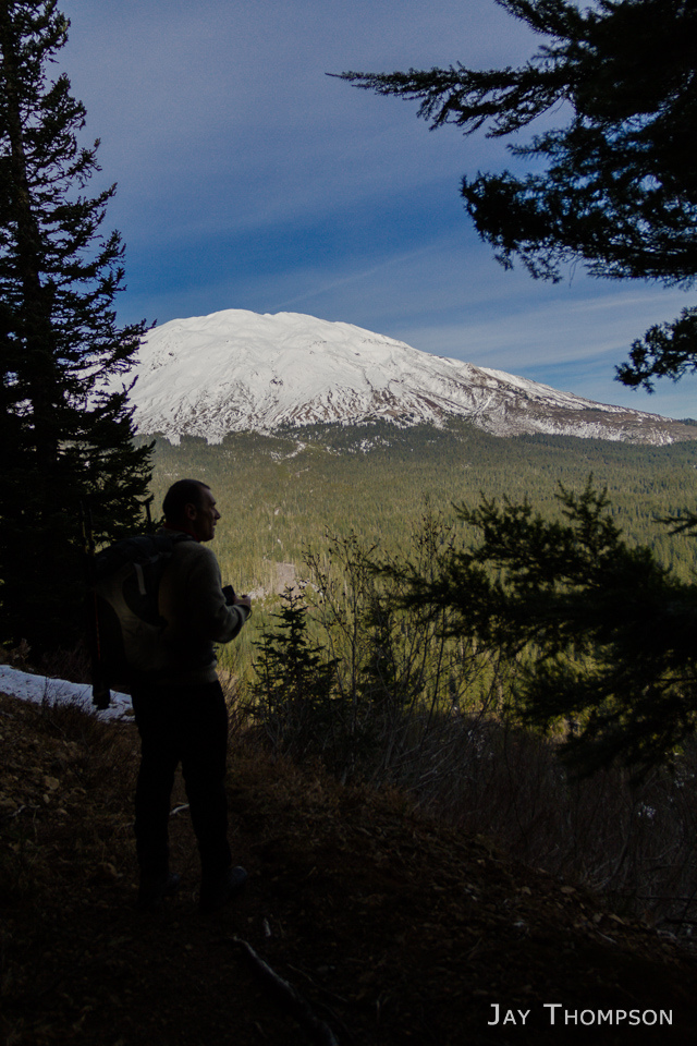
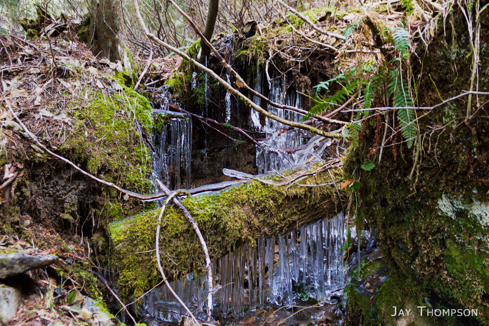
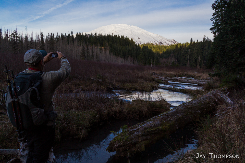
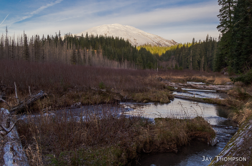
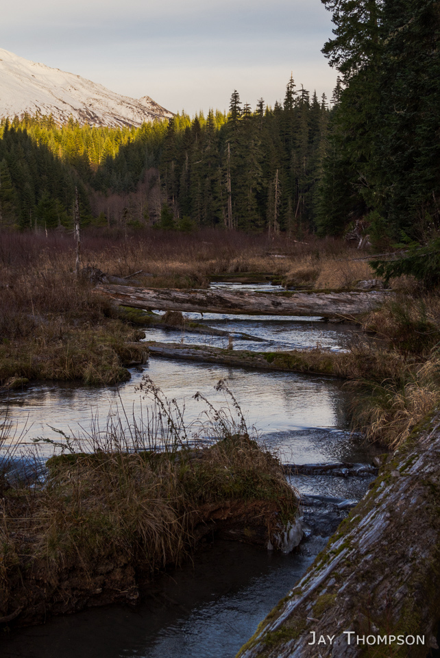
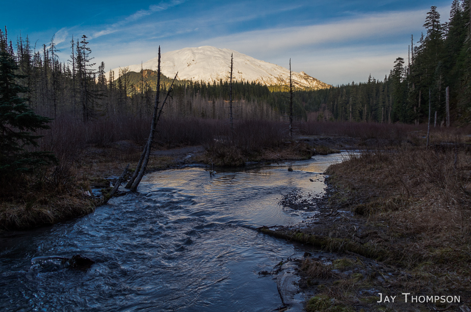
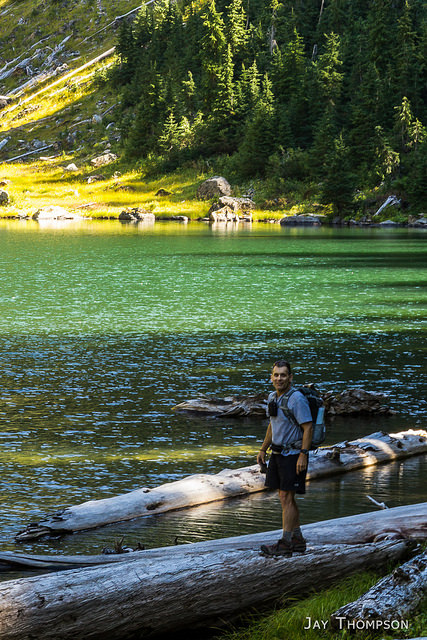
I was surprised to find that there is a lot of old growth timber in this area. Some very large trees. On the ridge, there were great views to the north of Saint Helens, and Goat Mountain. To the east, Mt Adams made its presence known and views to the south towards Oregon revealed a hazy and distant view of Mount Hood. Down in the river valley, McBride Lake was a bonus to the day. More of a meadow nowadays than a lake. You can almost envision an elk herd lounging about here as the Kalama babbles it's watery tune nearby. Along the final couple miles back to the car, we crossed several springs that were flowing out of the hillside with heavily icicle laden vegetation nearby.
For being an unknown (to me), the Cinnamon Trail (dare I call it the Cinnamon Loop?) turned out to be a nice little fall hike. Cinnamon is not exactly a pristine wilderness experience however. It does cross old logging roads a few times near the top and is open to horseback riders as well as mountain bikers. If you're like me though and like to be outdoors and enjoy nice views, I think you'll like it. Especially on a fall day when you are likely to have it all to yourself.
Map overview. Our hike started from the Kalama horse camp
Roll mouse over image to see route taken. No mouse? See GPS map at the end of this post.
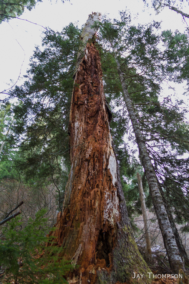
The trails in this area are slightly confusing. The Toutle trail follows the Kalama River here.After a short section of the Toutle trail, we hopped on to the Cinnamon Trail which crosses the Kalama river on a bridge before starting its climb to the top of Cinnamon Ridge.Crossing the Kalama River.It was cold out. On the drive down, the temps varied between the 20s and 30s with warmer air as we got closer to the trailhead due to a slight temperature inversion. This river valley was still clinging to its cold air. As we progressed along the trail throughout the day, the temps would swing wildly in either direction, also influenced by occasional strong winds. We would add and remove layers of clothing often throughout the day due to the fluctuating temps.The Kalama RiverSignage for a newish trail on land formerly held by timber interests.Winter is fast approaching.There were lots of photo opportunities.Craig with Goat Mountain in the background.Panorama of Goat Mountain and Mt Saint HelensRoad NOT closed. (at least not to us!)Once on the ridge line, we were sometimes inside the monument and sometimes out, as the trail made its way across the ridge, weaving back and forth across this invisible boundary.One of our first real good views of the mountain.This was about the deepest snow we would see as we crossed over to the north side of the ridgeAnother north facing section of trail. We were not having any trouble finding good views.More trail scenery. Lots of wide open views on Cinnamon Ridge.This is a four image panorama of Craig taking some notes from a nice vantage point. I assumed he was recording the location of the great view from this spot on the trail. Always working hard.This spot had one of the best views of the whole trail.Mount Adams peek-a-boo shot.Back on the south side of the ridge with Mt Hood in the hazy distance. We were wondering about all the haze but didn't discover it's origin until later.Mt Hood through the haze.Back on the north side of the ridge and just before dropping down to Red Rock Pass, we come to the final, and one of the best views from the trail.It was from here that we could see the source of the haze we had seen earlier. It looked kind of like a forest fire but I'm betting it was probably a slash burn or some other controlled type of fire.Closer view of the smoke. Mt Adams looming in the distance.This was quite the widow maker. This old guy was huge. I was surprised it was still standing for as rotted out as it was.Looking back up at the ridge as we made our way down to Red Rock Pass.More icicles. There were lots of springs coming out of the hillside and these icicles were everywhere.McBride Lake - or what remains of it. McBride was formed by a mudslide damming the Kalama, but it appears the lake is more of a meadow these days. High Dynamic Range (HDR) photo.McBride Lake was a real surprise. From above it looked like a swamp but it turned out to be quite beautiful.McBride Lake area. My camera was incapable of capturing all the different light levels due to the harsh sun on the mountain and dark shade of the lake area. This is a high dynamic range (HDR) composite of three separate exposures.Lovely McBride Lake. High dynamic range (HDR) photo.McBride Lake areaStrange looking icicles. The icicles on this trip were fascinating to me.McBride Lake area. High dynamic range (HDR) photo.McBride Lake area. High dynamic range (HDR) photo.This signaled the end of the trail for us. From here it was about a quarter of a mile down an abandoned road (a spur of trail #237) to where we left my car. We could have done a longer loop but we wanted a shorter option due to the uncertainty of the trail conditions. This was another great outing on a trail I probably never would have considered doing on my own.
Maps are for informational and entertainment purposes only. Use at your own risk!
How did the Cinnamon Trail get its name? I asked Craig the same thing. As a guidebook author, he has lots of experience tracking this kind of stuff down but he was unsure about Cinnamon. Sometimes these things can be hard to discover as it might have simply been called this by loggers whose stories are long gone. If you know how Cinnamon got its name, leave a comment below. I'd love to hear about it and I'm sure Craig would as well.
Click here to learn more about Craig Romano and some of the books he has written.
Jay-you should be writing books! I love your story telling and your photos are gorgeous-I may have to hire you for a photo shoot someday. Great as always hiking with you!
Wow, beautiful photos! I came across your website last week after Craig linked it on facebook, and I’ve already spent several hours looking at your photos. My wife and I want to hike the Wonderland Trail next year, so I really loved those! Great website Jay! It’s definitely one of my new favorites!
Jay…..love your photos, as usual. I particularly love the icicles – gorgeous! Have hiked some at MSH, but didn’t know about this trail. Nice to have some lower trails in the line up. Will give this one a try. Can’t wait for spring!
Hi Laurie! I still need to get our PCT hike on here. I kind of put it on the back burner until we get at least to White Pass. Cheryl and I need to come back down there and do that 20 mile section we missed that weekend. Maybe you can come meet us for that? I’m hoping to get it done this spring.
My son and I were just down in your neck of the woods a couple weekends ago. Cape Dissapointment for one night and Astoria the other. Sure is a beautiful area you live in.
The Cinnamon Trail was fun, but Craig tells me that the Strawberry Mountain trail is even better. I’m going to try to do that one this year as well as the Loowit Trail.
Hi Jay,
We sought out to hike Toutle but we think we hiked Cinnamon instead. We never made it down in the valley or to the Mcbride lake. Did you loop back to the lake when you came to Red Rock Junction? We aren’t sure how we got on Cinnamon and not to Toutle as we were following the book. Any insight would be great.
Gosh AB, sorry you couldn’t find the Toutle Trail but you were probably on it for a spell. If you started on the same trailhead we started at and went across the bridge going over the Kalama River then yes, you were probably on the Cinnamon Trail. We looped back on to the Toutle Trail when we got to Redrock Pass but only hiked it for a few miles before getting off at a different trailhead where we had staged a shuttle car. I updated my blog post above to show the map with the GPX data. It’s at the bottom of the post. Not sure why it wasn’t showing before but it’s there now.
 I once again had the pleasure of hiking a somewhat obscure route in the Mt Saint Helens area with guidebook author, Craig Romano. Craig is in the process of hiking all the trails in the Mount Saint Helens National Volcanic Monument as research for a new book he is writing. I am honored to accompany him on some of these hikes as he finishes up his research in an area that is near and dear to my heart.
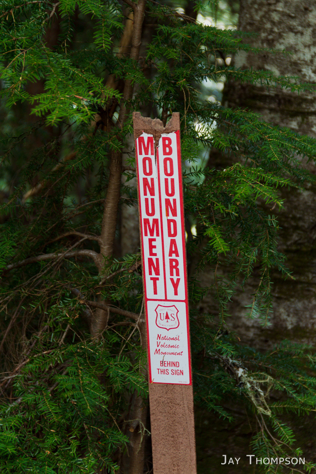 I was surprised to find that there is a lot of old growth timber in this area. Some very large trees. On the ridge, there were great views to the north of Saint Helens, and Goat Mountain. To the east, Mt Adams made its presence known and views to the south towards Oregon revealed a hazy and distant view of Mount Hood. Down in the river valley, McBride Lake was a bonus to the day. More of a meadow nowadays than a lake. You can almost envision an elk herd lounging about here as the Kalama babbles it's watery tune nearby. Along the final couple miles back to the car, we crossed several springs that were flowing out of the hillside with heavily icicle laden vegetation nearby.
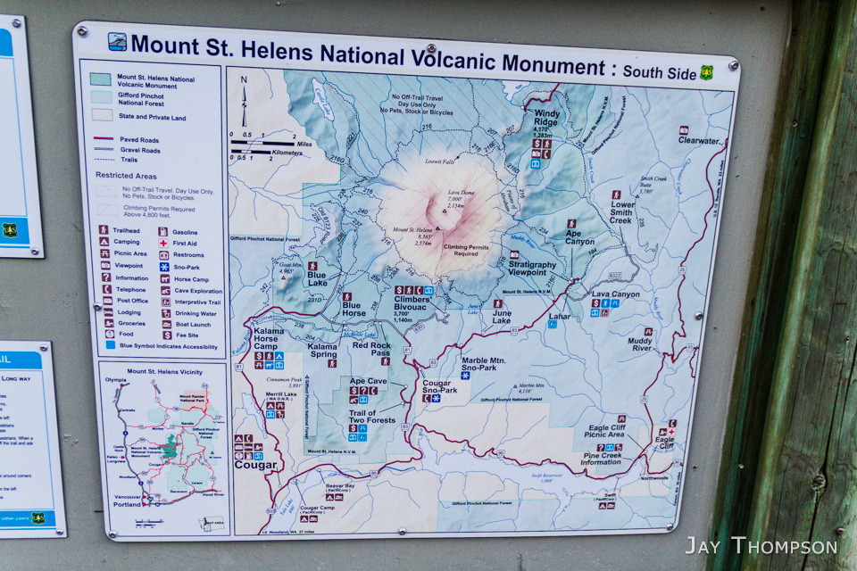


Great photos as usual, Jay!
Jay-you should be writing books! I love your story telling and your photos are gorgeous-I may have to hire you for a photo shoot someday. Great as always hiking with you!
Thanks Craig! I really enjoyed the hike. Lets do it again soon!
Love following your journeys, Jay!
Thank you both. You’re too kind. Just documenting my love of the outdoors!
Wow, beautiful photos! I came across your website last week after Craig linked it on facebook, and I’ve already spent several hours looking at your photos. My wife and I want to hike the Wonderland Trail next year, so I really loved those! Great website Jay! It’s definitely one of my new favorites!
I’m glad you’ve enjoyed the site Erik. Have fun on the Wonderland Trail. You’ll love it!
Jay…..love your photos, as usual. I particularly love the icicles – gorgeous! Have hiked some at MSH, but didn’t know about this trail. Nice to have some lower trails in the line up. Will give this one a try. Can’t wait for spring!
Hi Laurie! I still need to get our PCT hike on here. I kind of put it on the back burner until we get at least to White Pass. Cheryl and I need to come back down there and do that 20 mile section we missed that weekend. Maybe you can come meet us for that? I’m hoping to get it done this spring.
My son and I were just down in your neck of the woods a couple weekends ago. Cape Dissapointment for one night and Astoria the other. Sure is a beautiful area you live in.
The Cinnamon Trail was fun, but Craig tells me that the Strawberry Mountain trail is even better. I’m going to try to do that one this year as well as the Loowit Trail.
Good luck on securing WT permits this year!
Jay
Count me in for that 20 mile PCT section – I can help with car jockeying. Let’s get some summer hikes in – I’m ready!
Hi Jay,
We sought out to hike Toutle but we think we hiked Cinnamon instead. We never made it down in the valley or to the Mcbride lake. Did you loop back to the lake when you came to Red Rock Junction? We aren’t sure how we got on Cinnamon and not to Toutle as we were following the book. Any insight would be great.
Thanks!
AB
Gosh AB, sorry you couldn’t find the Toutle Trail but you were probably on it for a spell. If you started on the same trailhead we started at and went across the bridge going over the Kalama River then yes, you were probably on the Cinnamon Trail. We looped back on to the Toutle Trail when we got to Redrock Pass but only hiked it for a few miles before getting off at a different trailhead where we had staged a shuttle car. I updated my blog post above to show the map with the GPX data. It’s at the bottom of the post. Not sure why it wasn’t showing before but it’s there now.
Jay