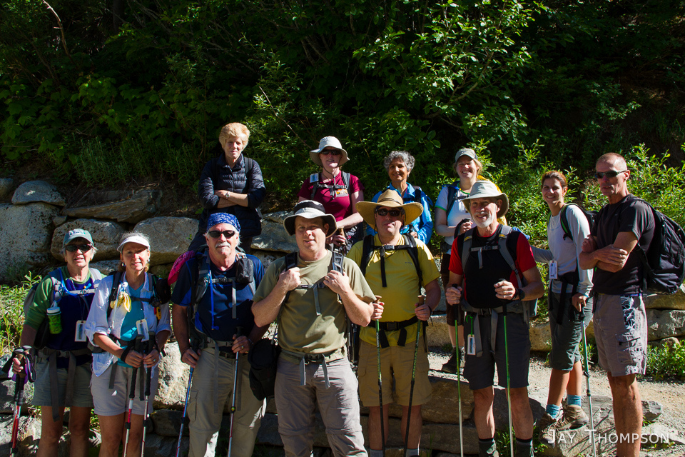
I had an itch to go for a hike in the North Cascades. Being so far from the Kitsap Peninsula, its easy to think the North Cascades are out of reach. The Cascade Pass trail, according to Craig Romano in this WTA post, is the only trailhead in the North Cascades National Park that you can drive to. After catching a 6:25am ferry (the earliest boat on a Sunday) across the Puget Sound from Kingston, I drove to the trailhead and was surprised to find myself at the trailhead by 9:30.
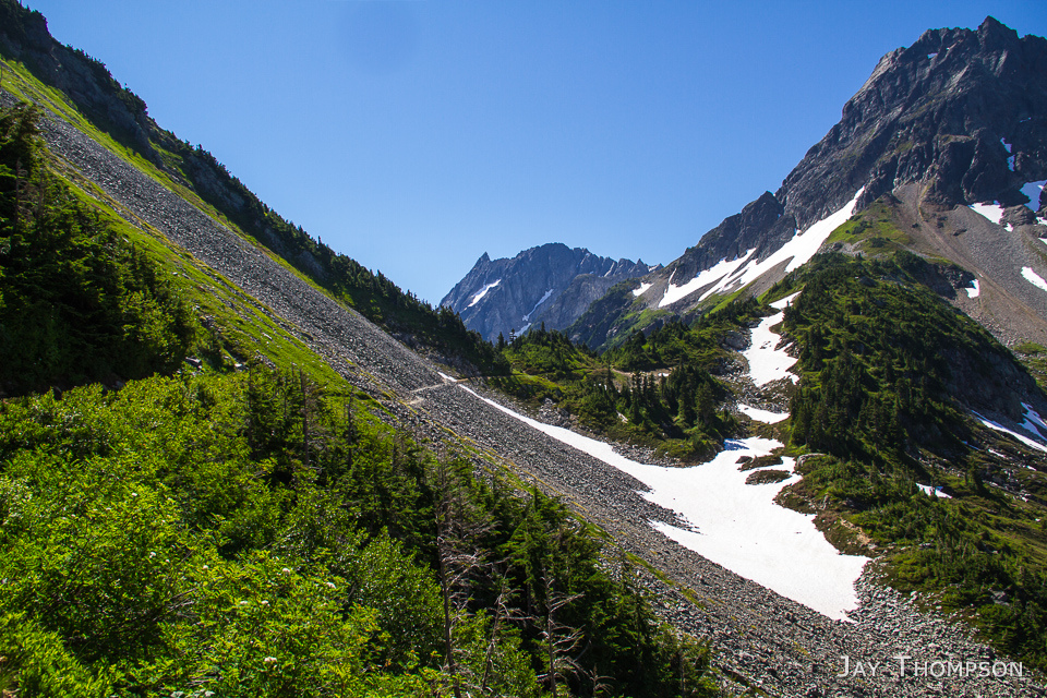
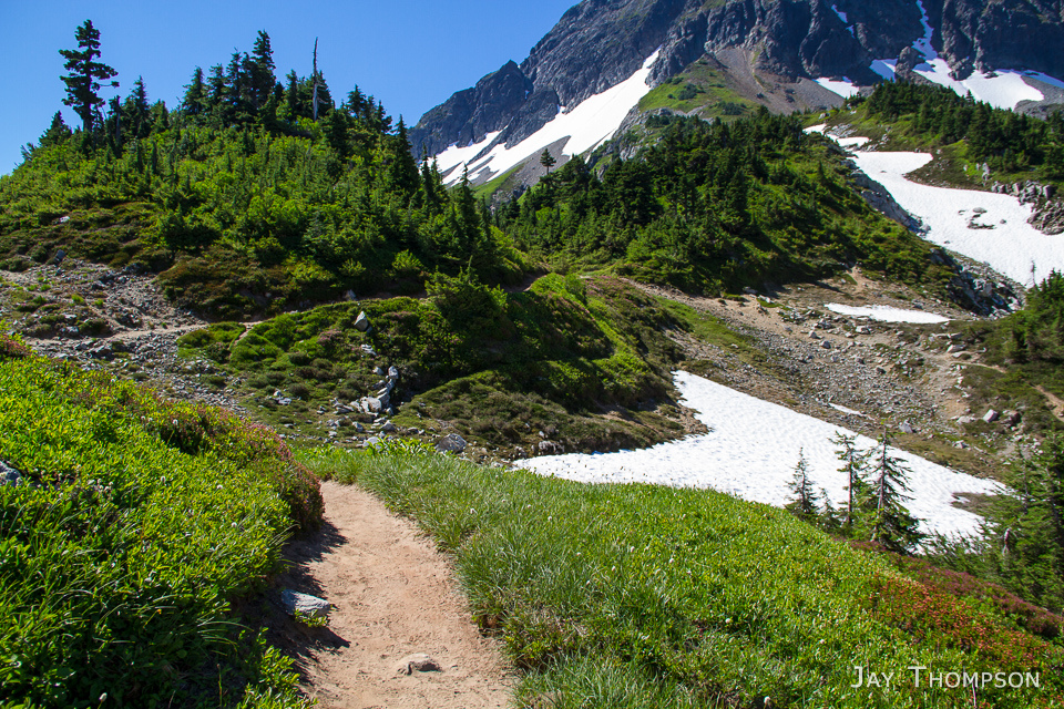
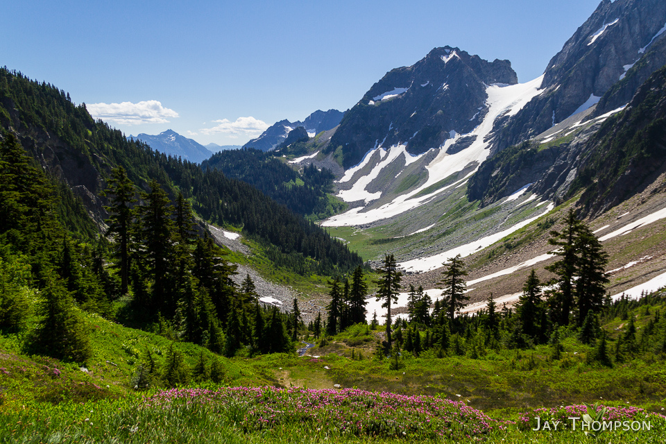
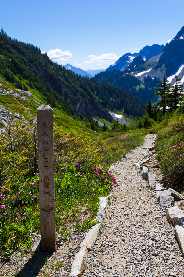
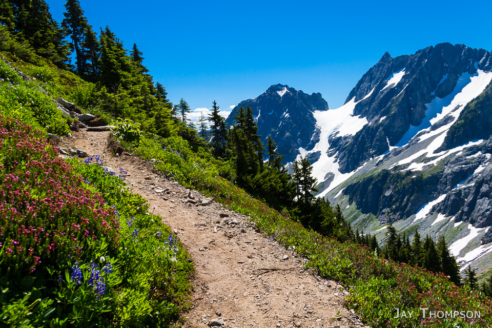
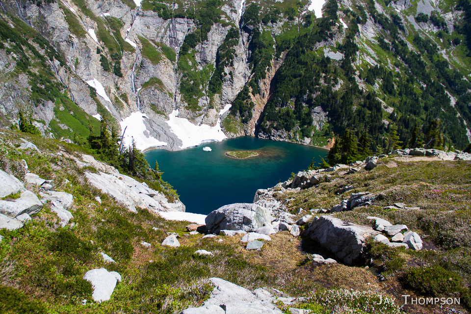
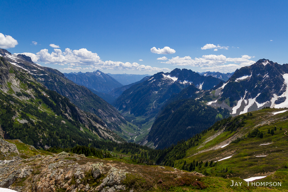
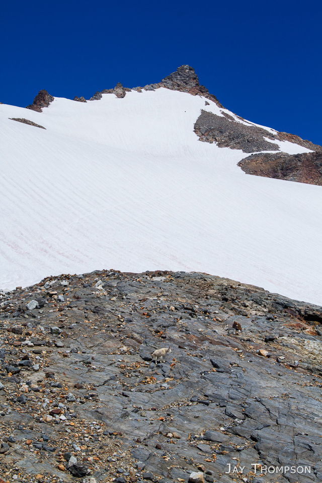
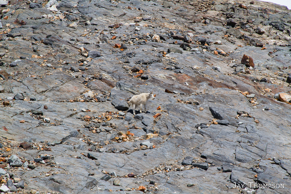
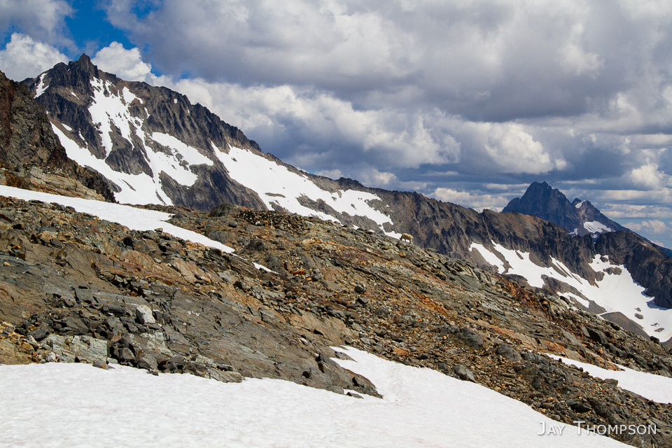
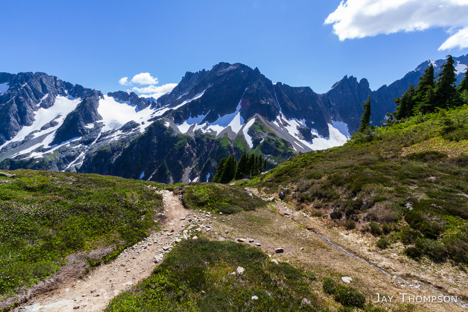
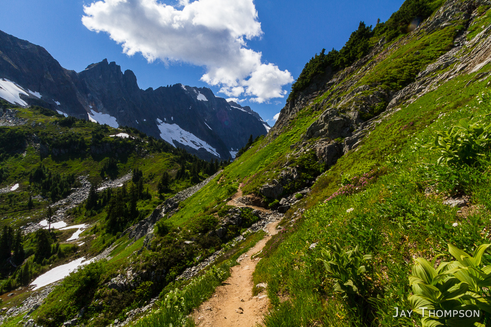
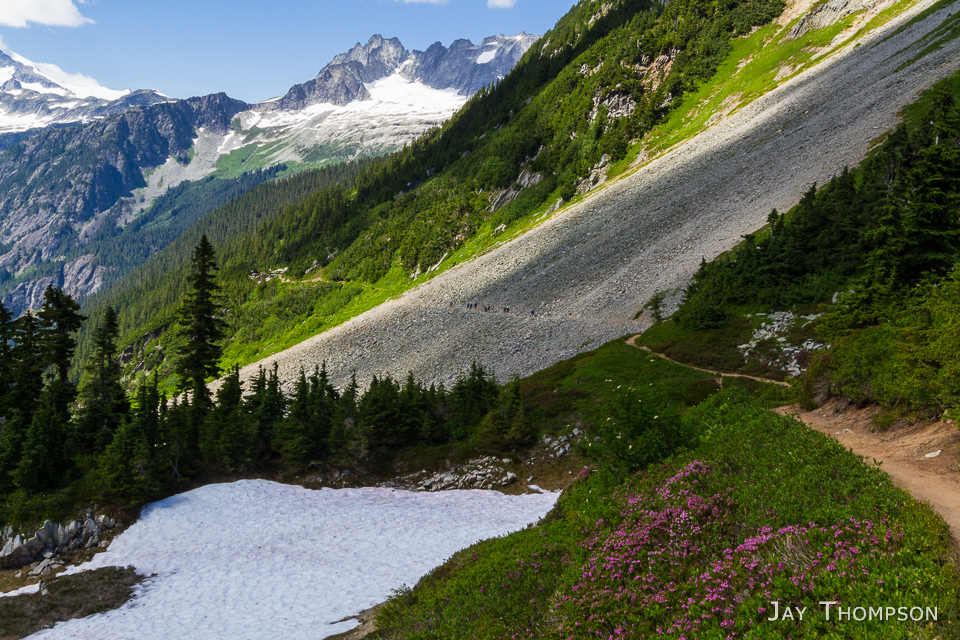
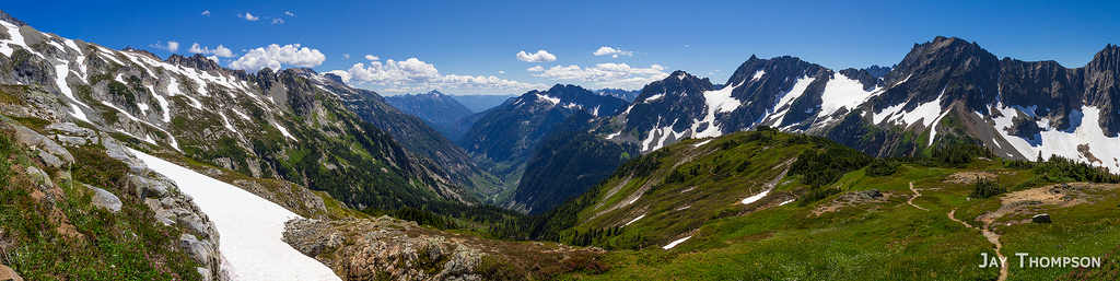
Hiking the trail is straightforward. It switches back and forth across the side of the mountain until you get to the pass 3 1/2 miles and 1700 feet in elevation gain later. When I was there, there were several little rivulets of water coming off the hillside all along the trail - finding water is definitely not an issue. At the pass itself, a Park Ranger was hanging out, probably checking people for camping permits and answering questions. I only had a daypack so he left me alone. There is a big flat area at the pass and being that it is kind of a crossroads, it is a natural gathering place for folks coming up from either the road, Stehekin, Sahale Arm or the Ptarmigan Traverse. After the pass, the trail continues 23 miles down to Stehekin, or you can take a left and go up to Sahale Arm. From here, the trail climbs about 800 feet in elevation until you reach the Sahale Arm itself. Once on the Arm, it is a lovely subalpine walk with a not too steep grade (or perhaps the stunning 360 degree views keep you from noticing the steepness) until you reach about the 7000 foot mark. Surprisingly, not mentioned anywhere I researched, the last 600 feet or so of elevation going up to Glacier Camp was the worst. It was steep, very rocky and the soil very loose in a lot of places. Nothing too horrible, but definitely the worst part of this hike. Once at the top, I got chilled quickly as it was windy up there. After a quick bite to eat, and snapping some photos, I was ready to head back down the almost 4000 feet of elevation to the trailhead.
Back on the road, I wasted no time driving home. I was on the 7:40 pm boat back to the Peninsula. Not bad time for a full day of hiking in the North Cascades.


Driving directions: From Marblemount on Hwy 20, take the Cascade River Rd 23 miles to a parking area at the trailhead. The road is paved for about a third of the way.
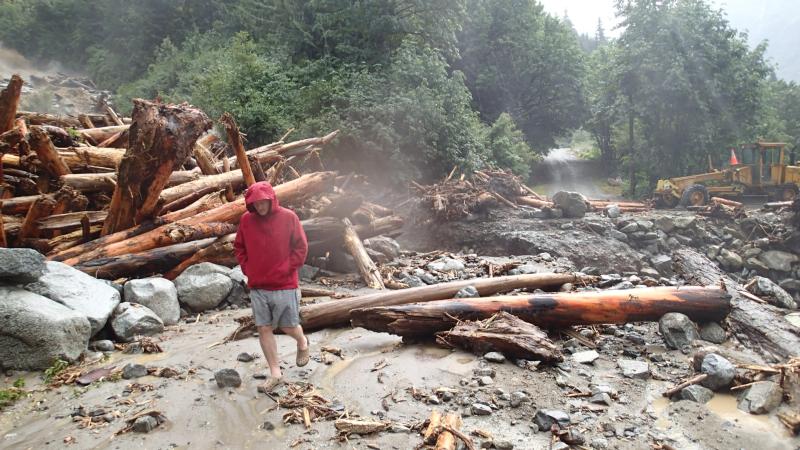
Update: Two weeks after my hike up Sahale Arm, Thunderstorms moved through the area bringing torrential rainfall. A landslide at an already bad logjam at Boston Creek on the Cascade River Road 3 miles from the trailhead caused a major washout of the road stranding 65 people at the trailhead overnight. Luckily for the stranded hikers, temporary repairs were made to get the folks out of there before more serious repairs to the road could be done. See the links below for the story.
Stranded in the North Cascades
65 stranded by Cascade River Road washout in N. Cascades

The road to that trail was washed out this past weekend! WTA has the details.
Yeah I included that information in the post.
Blush – I didn’t click on it and go past the first 3 lines…..
I just read it – I asked the ranger (when I was there 2 years ago) why – it’s because it is so popular that some people are not prepared for the heat, etc.
Great photos as always. Bummer about the landslide.
Thanks. Yeah I’m guessing this trail will probably be inaccessible until next year. Glad I got to it while I could.