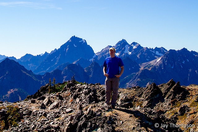
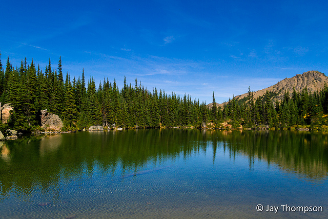
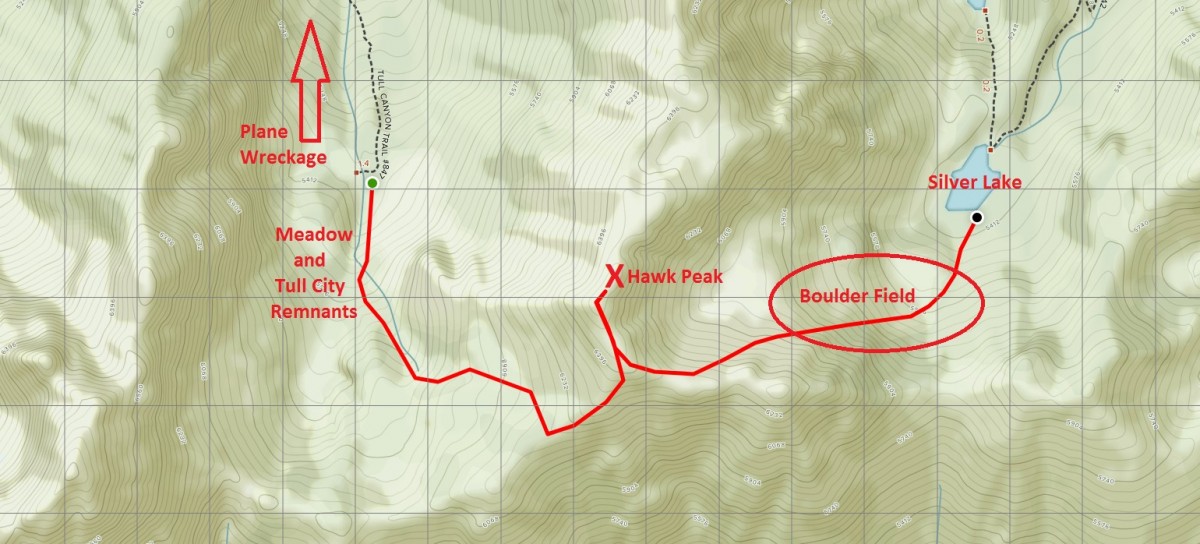
While looking for a place to hike this fine fall weekend, my friend Cheryl and I decided on Hawk Peak in the Olympic Mountains. You get to Hawk Peak by way of the Tubal Cain and Tull Canyon trails. I had been this route before on a hike we called the Koski Loop which is named after a guy in our hiking club, but the difference this time was while we still did a full loop, we didn't end up going up and over Mt Townsend this time. Instead, we came out via the Silver Lakes way trail which cut off three or four miles and around 1500 extra feet of elevation gain. See the bottom of this post for a map of the route.


Hi Jay, I was just showing my new coworker some of your pictures, she and her boy friend are hikers and they love waterfalls. Just wanted to let you know I was here. I am coming for a visit the 12th thru the 20th but don’t tell mom, it is a surprise. I am going to see Jeremy while I am there. Maybe you guys can come to moms and I can cook, Well love ya and see you in about a month
Hi Kathy. We’ll have to visit on the 19th or the 20th. I’ll be in California 13-18.
Hi Jay, we (with our adventure pup, Jasper) are thinking of doing the Tubal Cain, Tull Canyon, Silver Lakes loop (maybe adding Marmot Pass as a side trip). We are thinking of taking our time and spending 5- 6 nights out, with several at our favorite, Silver Lakes. I couldn’t figure out how to access your map and was wanting some info on camping in the Tull Meadow, hiking from Tull Cayon to the Tull Meadow and up to Hawk Peak, and the way down to Silver Lake. Is there a trail from Tull Meadow to Hawk Peak? If not is it easy to find your way? I understand the Meadow will be a dry camp and we will have to bring water from the Tubal Cain/Tull Canyon area.
We have hiked Silver Lake Way Trail many times and to the pass on the South Side of the lake. We have taken the small trail to the west for a ways and was wondering if this leads to the Tull Meadow? People seem to go up Hawk Peak and down the boulder field/scree slope to Silver Lake rather than the trail to the pass. We were wondering why? Does the little trail to the west of the pass not go to Tull Meadow/TullCanyon? Any help would be helpful. Thank you.
“We have taken the small trail to the west for a ways and was wondering if this leads to the Tull Meadow? People seem to go up Hawk Peak and down the boulder field/scree slope to Silver Lake rather than the trail to the pass. We were wondering why? Does the little trail to the west of the pass not go to Tull Meadow/TullCanyon?”
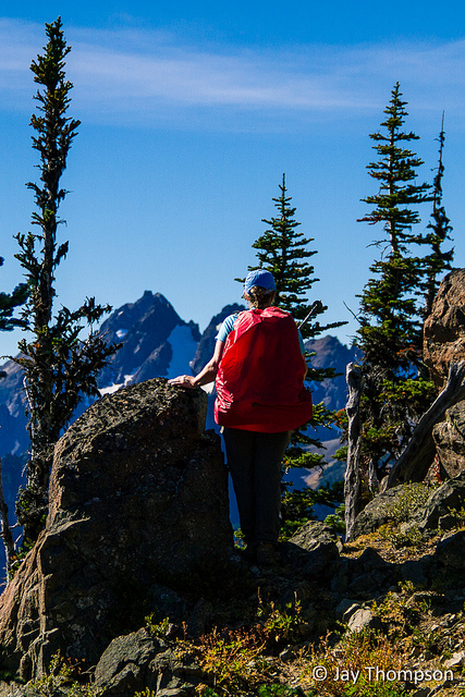
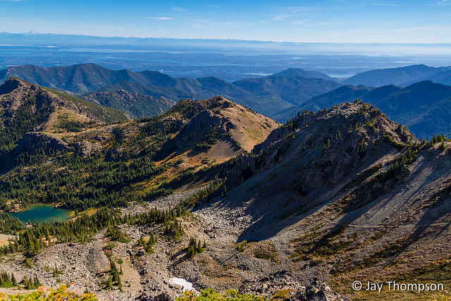
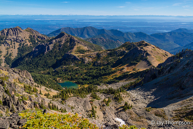
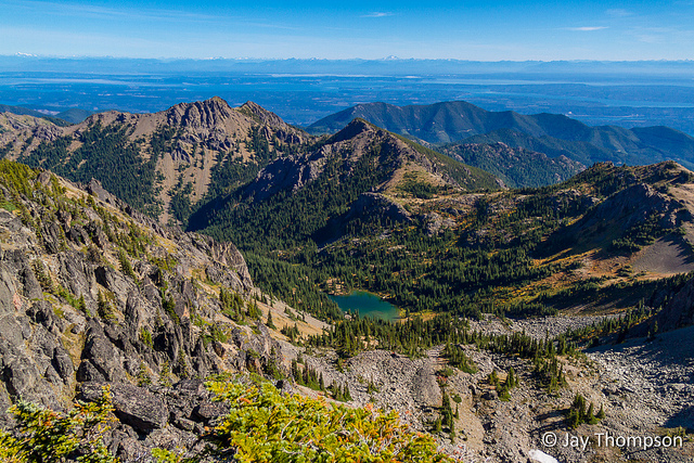
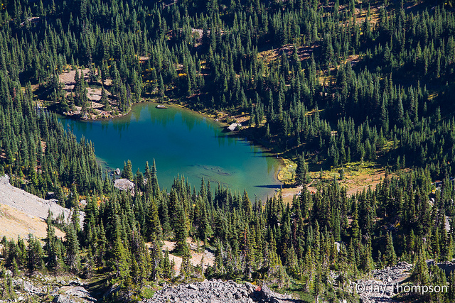
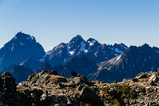
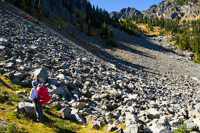
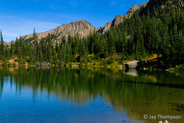
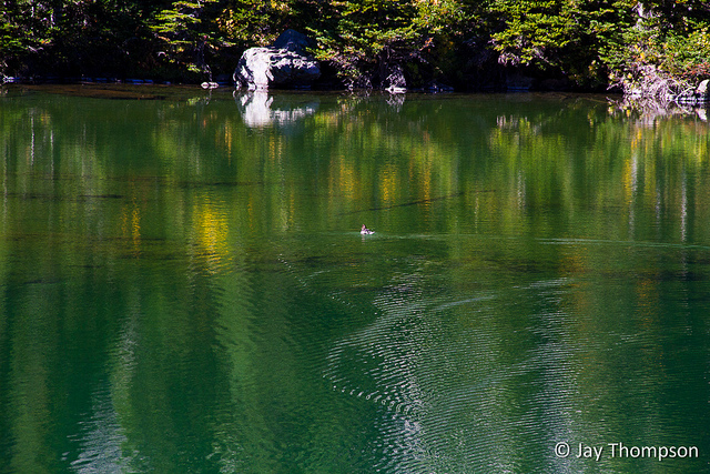
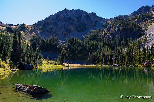
Hi Emily, If I’m following what you are saying, there is a trail going west on the ridge to the south of Silver Lake? If so I would think you could try following it and seeing if it goes all the way over to the saddle above Tull Canyon. If you look closely at the sixth and seventh images above, you’ll see the way trail going down towards the lake. I think why most people go that way is because they can see the trail and it begins easily enough down the mountainside like a regular trail. Soon enough however it peters out and drops you right into the big boulder field. If you look at the seventh picture above, smack in the middle of the picture is what I assume is the pass you refer to south of the lake. As you can see, you would need to climb quite a bit on that ridge to get to Hawk Peak from there and to the Tull Canyon/Meadow.
“Is there a trail from Tull Meadow to Hawk Peak?”
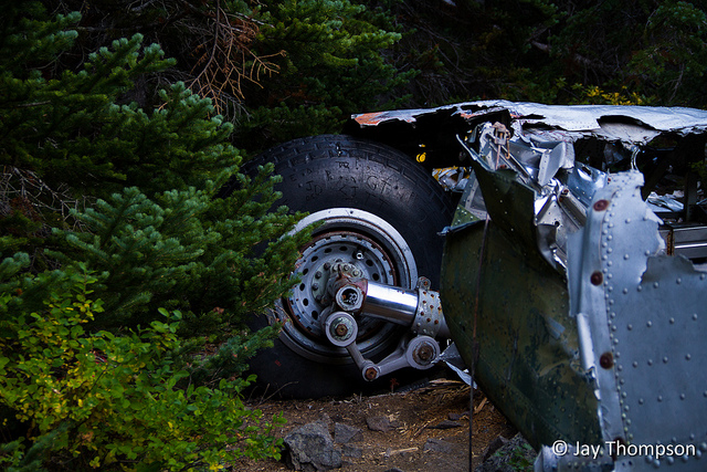
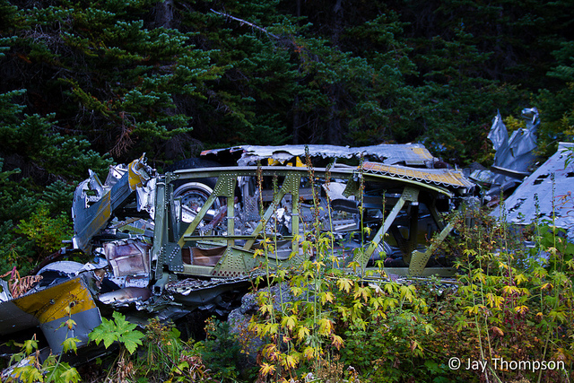
To get to Hawk Peak, take the Tubal Cain trail to the Tull Canyon turnoff. Most maps have have the Tull Canyon trail on them. When you get to the plane wreckage, follow the creek up the valley. This is Tull Canyon (not really much of a canyon to be honest). Just follow that up. You’ll easily find the way trail that goes up. When it starts to get steep, the trail will peter out. Start to veer to the left (east, south-east) for Hawk Peak. If you don’t veer left, you will end up on the saddle between Mt Worthington and Hawk Peak. Tull Meadow? Well, there are a few nice places that are flat enough to camp just below the saddle. If you look around you will see some evidence of the old miner’s cabins that used to be here (Tull City).
I apologize, my maps plugin seems to not be working anymore. I’ll post an image of the map to the bottom of this entry.