
Day 1
On the weekend of May 21-22, I sponsored a trip to the Columbia River Gorge for my hiking club the Peninsula Wilderness Club. Everyone met at my house at 7:30 on Saturday and we drove straight to our first destination, Hamilton Mountain.
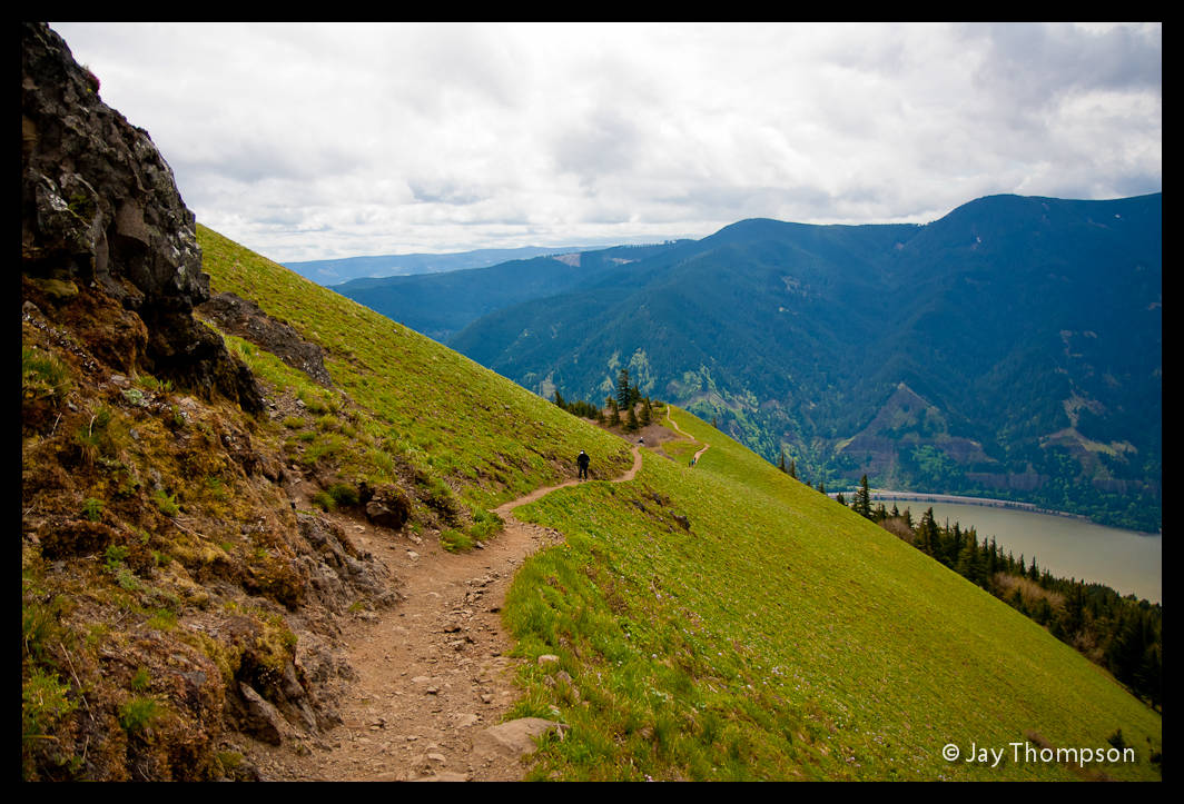
Hamilton Mountain is a 2488' mountain in Washington State that overlooks the Columbia River Gorge and the Bonneville Dam and is located in Beacon Rock State Park. Along the hike to the top, one see's Hardy Falls, Rodney Falls, Pool of the Winds as well as spectacular views of Hamilton itself, the Columbia River Gorge and the peaks across the river in neighboring Oregon. A good option for this hike is to make a 7.5 mile loop utilizing the Hardy Creek Trail.

We reached Hamilton Mountain and started the hike around 11:15. The hike up was fun but otherwise un-eventful. We all took a stop at the Pool of the Winds and took turns doing a short little scramble to a little notch next to the falls there. Not much room to get around in but we got to see the secret area mentioned in the Pokin' Round the Gorge (NSFW) book .

At the top of the mountain, lunch was enjoyed as we checked out the views. We discussed the river and the Bridge of the Gods and how it got its name. Plans of upcoming hikes for the year were talked about. Before long we were on our way back down the mountain. Getting to camp was fast becoming the top priority and we still had miles to hike.

Mitchell Point

After getting to camp and getting set up, myself and fellow club member and friend Isaac Sun headed across the river to do another hike. Our goal this time was Mitchell Point.

Mitchell Point is a 1178' prominent spur that sticks out like a sore thumb as you drive I-84. Heading east take exit 58 to the Mitchell Point Overlook. Originally there was a beautiful tunnel here built for the old hwy. The tunnel was destroyed when I-84 was built. The overlook is a reminder of the views that could be had from the windows that were cut into the side of the tunnel that overlooked the river.

After already gaining a cumulative 2500' in elevation for the day, the sound of another 1000' or so was not sounding that great. We parked and quickly made our way to the trail. The last time I hiked up this trail, the poison oak was about the thickest I had ever seen. It was so thick that I had a very hard time not letting it touch the cuffs of my pants as I made my way up. This year however has been a very cold spring and the poison oak was still a ways off from it's full potential. Since Isaac had never seen it before so I was busy looking for samples to show him so he would know what to avoid.

The trail was much steeper than I remembered and we were soon wishing we had brought our hiking sticks for the return trip. We made really good time. A guidebook we had said to allow 2 1/2 hours round trip but we made it to the top in about 45 minutes, and back down in about 25 minutes. This trail is one of the best bang for your buck hikes I have been on in the Gorge and the access right off the freeway makes it very easy to accomplish as a secondary hike for the day.

Below is a short video I shot of Mitchell Point a couple years ago.
Rowena Point - Tom McCall Preserve
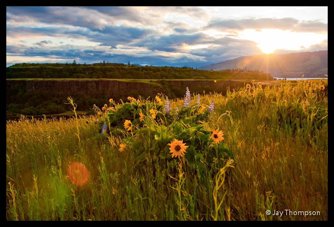
Our final stop for the day was at Rowena Point or Rowena Plateau. This is the place of the Nature Conservancy's Tom McCall Preserve. Tom McCall was a former governor of Oregon whose dedication to conservation was the inspiration for the preserve. The flowers here are among the first to bloom in the gorge and the area is a major destination for photographers.We arrived just in time for the sunset.

We took a bunch of photos as we walked down to the first pond on the plateau. The Rowena Plateau is one of my favorite places. I try to come back here every spring.

To get here, drive east on I-84 to the Mosier exit 69. Turn right at the freeway offramp and follow the Historic Columbia River Highway through Mosier. Continue east on the old highway for about 7 miles. Look for the Rowena Crest sign with a turnoff to the right.


Below is a video from 2009 I made that features Tom McCall. The video shows off other parts of the Gorge as well so if you want to skip right to the Rowena section, advance the video to about 3:30 and watch from there.
Day 2 - Dog Mountain
On day two we all got up early and headed out to Dog Mountain. My goal was to start early because Dog Mountain is one of the most popular hikes in the Gorge and I wanted to get to the trailhead early before the parking lot filled up.

Dog Mountain is a steep hike that is famous for its springtime flowers. At 2948' high, the steepness and length of this hike do not seem to deter the hordes of people that are determined to see the flowers each year. In fact even without the flowers, the views from the top of Dog are surely some of the best in the Gorge. It is not unheard of for the high capacity parking lot to be overflowing on a spring weekend. To get to the trailhead, go east on hwy 14 through Stevenson and past Wind Mountain. The parking lot is on the left near mile post 53. A Northwest Forest Pass is required to park at this trailhead.


We started hiking around 9:00 am. After having climbed roughly 3500' the previous day, I was pretty tired and was really slow going up the trail. I had some really bad leg cramps that didn't go away until I was near the top of the mountain. I was by myself for almost the whole hike up I was so slow. This was a real wake-up call for how out of shape I had become over the winter. When I had reached the top, the others were all huddled around shivering in the wind, eating lunch. I quickly found something to eat and we all headed down the Augspurger trail to make a loop out of the hike.


All in all, this was a good weekend of hiking with great people, but it could have been better if the weather would have been warmer.

Beautiful pictures