Goat Rocks Wilderness
Snowgrass Flat and Goat Lake
September 7th 2008
After the crappy weather during Labor Day weekend this year, and after sitting around the house all day Saturday feeling sorry for myself because I gave up on an attempt to hike the Loowit Trail around Mt St Helens, I got up Sunday and drove myself down to the Goat Rocks for a Snowgrass Flat / Goat Lake loop day hike.


I felt like I totally redeemed myself for wimping out earlier this weekend. Goat Rocks was everything I expected it to be, and more. It is so beautiful up there that I cannot find the words to describe it, but I can try, and YOU can see the pictures without hiking the 15 miles.

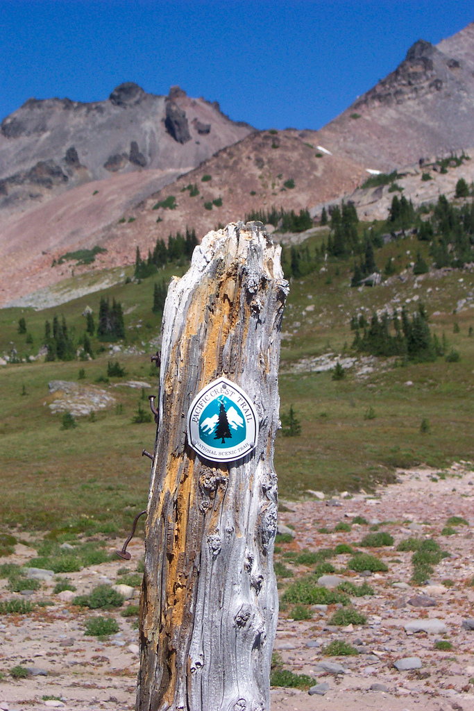
I got up Sunday (9-7-08) at the early hour of 7:30am (OK early for me on a day off from work, I like to sleep in) and had my pack, uhh packed and was out the door at 8:10. I knew the Goat Rocks were a good haul from Silverdale. I Google mapped the distance to Packwood and Google reported 113 miles to Packwood. OK couple hour drive, no problem. Wrong! It was 3 hours door to door with only a drive thru at Mickey Dees. I quickly got on the trail after arriving at the Berry Patch parking area at 11:10. My plan was to hike up to Snowgrass on the 96 trail, and on up to the PCT and explore a little. I would then drop back down to the 86 trail and follow it over to Goat Lake and check that out before the intersection with the 95 trail which would bring me back to my car by way of Goat Ridge. About a quarter mile up the trail from the parking lot, I realized my hiking poles were in my car still. I turned around to head back down to get them and just as quickly called it off and decided to do this one without the sissy sticks. My guide book said the hike I wanted to do would take 8 hours, so I hurried along pushing myself pretty hard to climb the trail and get as many miles in as quickly as possible to try to make up some time, jumping the hurdles of horse crap along the way.

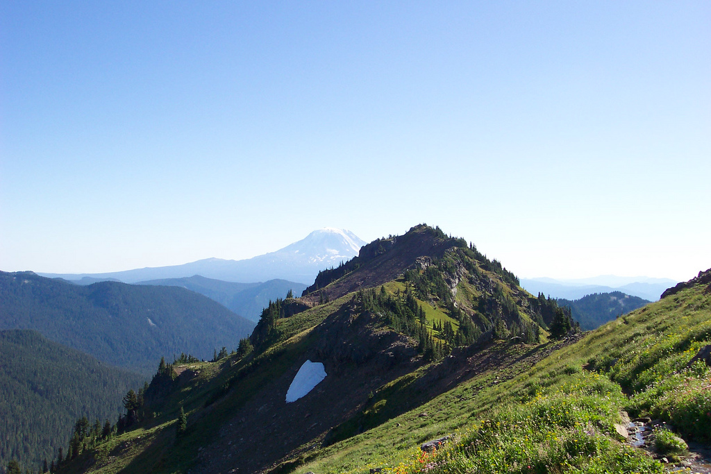
With an 8 hour hike, I wasn’t due to be back at the car until 7:00 pm. Add another 3 hour drive and I was looking at 10:00 before I got back home, and I had to work the next day. Cruising along on the trail a young kid wearing dark clothes rounded the bend and scared the bejesus out of me. Thought it was a bear coming at me. After the young man passed me another kid came around the bend, this one without shoes. Weird, wonder what he was thinking? Then his mother came by carrying his shoes and a couple of other people that were part of the same group. I heard that Snowgrass Flat had made the WTA hike of the week a few weeks back and the hordes soon followed. That was a couple of weeks ago however, and while I saw a few groups going down, it was nowhere near the multitudes of people up there (in the bad Labor Day Weekend weather) from the previous week that I had heard about. The weather on this day was glorious in Washington state terms. There was hardly a cloud in the sky and no rain as we had the previous weekend. I wish I had made my plans to hike up here all weekend instead of screwing around with the Loowit. Don’t get me wrong, I know the Loowit would have been spectacular in its own right, I just did not feel comfortable hiking it alone. Too bad I had to get out there and start hiking it before I came to that conclusion. As I was saying, the weather this day was spectacular, sunny and in the mid to upper 60s, perfect for hiking. I got up to the Flat and beyond, up to the PCT, and explored a little. I took several photos. The foot traffic seemed to be heaviest up here. Between Alpine Camp and the PCT (about a mile), I counted around 20 people, either hiking or camped at one of the multiple campsites along the trail. I thought the best part of the trail would be up on the PCT above Snowgrass Flat. The views up here were pretty good to be sure. Mount Adams looked very close.

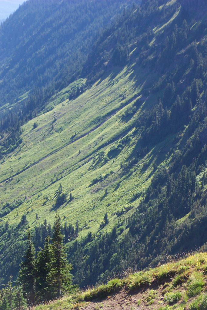
I almost thought it was Rainier but after looking at my maps concluded that it must be Adams. The views just got better when I started hiking towards Goat Lake. Once I got onto trail 86, I couldn’t walk more than a few hundred yards before I had to stop and take some more pictures, a reflection in a tarn here, flowers and snowgrass in a meadow there, waterfalls, peaks, unique rock formations, I was in heaven on earth.


Old Snowy
Truly, this is one of the most beautiful places I have ever been, and that is not to be taken lightly as I’ve been to a lot of places in my life. I soon hiked up over the last little hill before seeing Goat Lake. Out of the corner of my eye, I see movement. Looking down I see an older woman pulling up her pants as she had been trying to cop a squat and got caught. Sheesh! You would think she could have done it a bit further away from the lake, like the side that drains away from, rather than into the lake. I found a nice rock to sit on and enjoy my lunch of a King Size Snickers bar and banana. This was the only time I sat down on the whole hike, in fact the only break I took other than to catch my breath or take a picture. I looked over to see what the older couple was doing and can you believe it, they were pitching their tent right next to the lake. I’m pretty sure there is no camping within a hundred feet of the lake. Sadly, some people feel the rules are just not meant for them.


After my lunch I started to head back onto the trail when an old man named Steve stopped me to ask if we could take each other’s pictures.

We chatted for a few minutes and he let me look at his great Goat Rocks map. Much better than my 2 green trails maps, and I still needed 2 more just for this little hike. We traded web journal information and parted ways.

Me and my goofy hat. Kept my neck from burning
I made my way up the last little uphill stretch to the crest of goat ridge and started down the other side, but not without about 5 stops to take more pictures first.


Goat Ridge

Jordan Basin
As I started down the other side I could see Jordan Basin. It was very pretty. There was nothing about this trip that was not pretty. Even the long walk through the woods was nice. As I started down into Jordan Basin, the trail became very steep as the guidebook said it would be. Hard to believe people bring their horses up here but they do. I was still hurdling horse crap even on this steep stretch.

Jordan Basin
Once past Jordan Basin the trail went through some nice areas that had more Snowgrass (Anemone Occidentalis) than I had seen in Snowgrass Flat.


Anemone Occidentalis

The trail seemed to get even steeper. I came across a large choss pile and heard something squeaking. Running in and around the rocks I spied a Pika. it sounded like one one those squeak things in a dog toy.

Can you find the Pika?
I ran into a party of about ten people on the way down and they were speaking some kind of foreign language I didn’t understand. One guy said hello though. I kept going and noticed the group was behind me. I turned on the afterburners and left them near a junction in the trail. According to the guidebook, the junction lets you take the 95A trail to a lookout 300 feet above or stay on the 95 trail that goes below the lookout. They both join back up, and since I was in a hurry to get back to my car I decided to skip the lookout. Down, down, down I went. This trail seemed to go on forever, but that’s how I always feel about 12 miles into a hike. Eventually I see chrome sparkling in the distance below and breathe a sigh of relief as my car comes into view. A couple of vitamin I (ibuprofen) later and the last of my water and I’m headed home. A check of the clock says 6:05. I did the hike in 7 hours. The guidebook says 8 hours. I did a couple extra miles when I headed up to the PCT and back down to the 86 trail so I felt pretty good about the time I made, however I was sad that I could not have spent a little longer in this beautiful place.
How to get there
From Packwood
Drive US 12 South 2.5 miles and turn East on Johnson Creek Rd #21. At 15.7 Miles, just past Hugo Lake, turn left on road #2150, signed "Chambers Lake," and at 18.5 miles turn right on road # (2150)040, then right again on #(2150)405 to the Berry Patch trailhead, 21.5 miles from Packwood.
Gifford Pinchot National Forest Homepage
Other Things to consider
The Goat Rocks Crest is the highest point of the PCT in Washington. The weather can change in a heartbeat in the mountains and the Goat Rocks Crest is no exception. Be prepared, even if the forecast is for sunny weather. People have died of hypothermia in the Goat Rocks. Be prepared for the worst and come home safe no matter what the weather brings you. The ten essentials are a must.
